
IMAGES TAKEN NEAR TO
The Manse, CHESTER LE STREET, DH3 3TG
Introduction
This page details the photographs taken nearby to The Manse, DH3 3TG by members of the Geograph project.
The Geograph project started in 2005 with the aim of publishing, organising and preserving representative images for every square kilometre of Great Britain, Ireland and the Isle of Man.

There are currently over 7.5m images from over14,400 individuals and you can help contribute to the project by visiting https://www.geograph.org.uk
Image Map
Images are licensed for reuse under creativecommons.org/licenses/by-sa/2.0
Notes
- Clicking on the map will re-center to the selected point.
- The higher the marker number, the further away the image location is from the centre of the postcode.
Image Listing (67 Images Found)
Images are licensed for reuse under creativecommons.org/licenses/by-sa/2.0
Image
Details
Distance
1
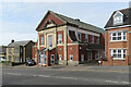
Chester-le-Street Community Centre, Newcastle Road
A nearby information board explains that the centre was opened on 30 November 1929 as South Pelaw Colliery Miners' Welfare Hall. After the pit closed in 1964 "the hall became a community centre very well supported by local residents".
Image: © John Sutton
Taken: 22 Apr 2022
0.02 miles
2
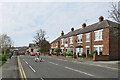
Chester-le-Street: on Newcastle Road
Nearing the centre of the town on an April morning.
Image: © John Sutton
Taken: 22 Apr 2022
0.02 miles
3
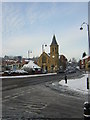
Chester-le-Street market place
During 28th December snowfall.
Image: © rob bishop
Taken: 28 Dec 2005
0.05 miles
5
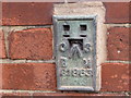
Ordnance Survey Flush Bracket S1863
This bracket can be found on the wall of The Adult Centre in Chester-le-Street. The benchmark height is recorded as being 13.9538 metres above sea level.
For more detail see : http://www.bench-marks.org.uk/bm20742
Image: © Peter Wood
Taken: 31 Mar 2017
0.06 miles
6
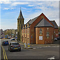
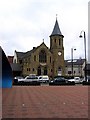
Chester-le-Street Methodist Church and schoolroom
A plaque explains that the Primitive Methodist Central Chapel, on the corner of the Market Place, was built in 1902. The brick schoolroom dates from 1886.
Image: © John Sutton
Taken: 22 Apr 2022
0.06 miles
7
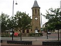
Chester-le-Street Methodist Church
At the market square in the town centre.
Image: © James Denham
Taken: 27 Jun 2014
0.08 miles
8
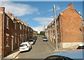
Prospect Street in Chester-le-Street
Image: © Peter Robinson
Taken: 11 Aug 2013
0.08 miles
9
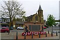
War memorial, Market Place, Chester-le-Street
Memorial unveiled in 2014 to the dead of both World Wars, and one later http://www.newmp.org.uk/detail.php?contentId=11343 . Behind is the Central Methodist Church.
Image: © Tim Heaton
Taken: 18 May 2023
0.08 miles
10
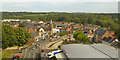
B6313 North Burns, Chester-le-Street
The Central Methodist Church is prominent.
Image: © Robin Webster
Taken: 14 Sep 2019
0.08 miles