Chester-le-Street Community Centre, Newcastle Road
Introduction
The photograph on this page of Chester-le-Street Community Centre, Newcastle Road by John Sutton as part of the Geograph project.
The Geograph project started in 2005 with the aim of publishing, organising and preserving representative images for every square kilometre of Great Britain, Ireland and the Isle of Man.

There are currently over 7.5m images from over 14,400 individuals and you can help contribute to the project by visiting https://www.geograph.org.uk
Chester-le-Street Community Centre, Newcastle Road
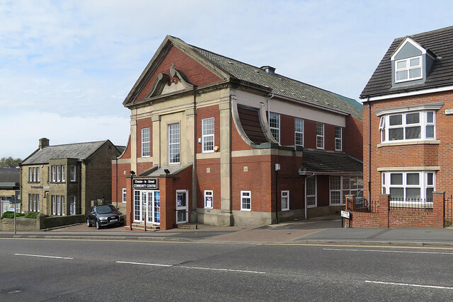
Image: © John Sutton Taken: 22 Apr 2022
A nearby information board explains that the centre was opened on 30 November 1929 as South Pelaw Colliery Miners' Welfare Hall. After the pit closed in 1964 "the hall became a community centre very well supported by local residents".
Images are licensed for reuse under creativecommons.org/licenses/by-sa/2.0
Image Location
Latitude
54.860062
Longitude
-1.574531