
IMAGES TAKEN NEAR TO
George Street, CHESTER LE STREET, DH3 3NE
Introduction
This page details the photographs taken nearby to George Street, DH3 3NE by members of the Geograph project.
The Geograph project started in 2005 with the aim of publishing, organising and preserving representative images for every square kilometre of Great Britain, Ireland and the Isle of Man.

There are currently over 7.5m images from over14,400 individuals and you can help contribute to the project by visiting https://www.geograph.org.uk
Image Map
Images are licensed for reuse under creativecommons.org/licenses/by-sa/2.0
Notes
- Clicking on the map will re-center to the selected point.
- The higher the marker number, the further away the image location is from the centre of the postcode.
Image Listing (40 Images Found)
Images are licensed for reuse under creativecommons.org/licenses/by-sa/2.0
Image
Details
Distance
2
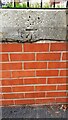
Benchmark on wall fronting Evangel Church west side of Durham Road
Ordnance Survey cut mark benchmark levelled at 25.305m above Newlyn Datum verified 1964
Image: © Roger Templeman
Taken: 11 Oct 2022
0.07 miles
4

Edward VII GPO cable marker against the wall in front of Evangel Church
For details of the marker see https://gpo-markers.derektp.co.uk/detail?post=609
Image: © Luke Shaw
Taken: 11 Oct 2022
0.09 miles
5
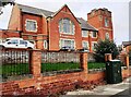
Evangel Church on west side of Durham Road at Clifford Terrace junction
There is a GPO cable marker Image in the pavement against the wall in the middle of the image
Image: © Luke Shaw
Taken: 11 Oct 2022
0.10 miles
6
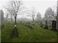
Ropery Lane Cemetery, Chester-le-Street
Lines of graves in Ropery Lane Cemetery. The photo was taken during a snow shower on a freezing cold day in mid March.
Image: © Graham Robson
Taken: 17 Mar 2018
0.10 miles
7
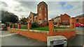
Evangel Church on west side of Durham Road
There is an Ordnance Survey benchmark Image on the coping stone midway between the two brick wall piers left of the salt bin
Image: © Roger Templeman
Taken: 11 Oct 2022
0.10 miles
8
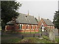
Chapels, Ropery Lane Cemetery, Chester-le-Street
The pair of chapels in Ropery Lane Cemetery, located off Ropery Lane in Chester-le-Street.
Image: © Graham Robson
Taken: 17 Mar 2018
0.12 miles
9
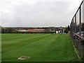
Chester-le-Street: Ropery Lane Cricket Ground
A view along the boundary towards the scoreboard, with the bellcote of St Cuthbert's RC Church above it and Lumley Castle on the skyline to the left. Chester-le-Street CC plays in the North Eastern Premier League.
One County Championship match was played here, in 1993, Durham's second season as a first-class county: Durham (308 and 164) lost to Nottinghamshire (629) by an innings and 157 runs.
Image: © John Sutton
Taken: 12 Apr 2012
0.14 miles
10
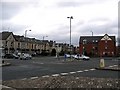
Mini roundabout
Junction of Waldridge Road, Front Street, Ropery Lane and Durham Road.
Image: © Roger Smith
Taken: 5 Apr 2008
0.15 miles