
IMAGES TAKEN NEAR TO
Conyers, CHESTER LE STREET, DH2 3PE
Introduction
This page details the photographs taken nearby to Conyers, DH2 3PE by members of the Geograph project.
The Geograph project started in 2005 with the aim of publishing, organising and preserving representative images for every square kilometre of Great Britain, Ireland and the Isle of Man.

There are currently over 7.5m images from over14,400 individuals and you can help contribute to the project by visiting https://www.geograph.org.uk
Image Map
Images are licensed for reuse under creativecommons.org/licenses/by-sa/2.0
Notes
- Clicking on the map will re-center to the selected point.
- The higher the marker number, the further away the image location is from the centre of the postcode.
Image Listing (6 Images Found)
Images are licensed for reuse under creativecommons.org/licenses/by-sa/2.0
Image
Details
Distance
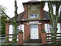
2
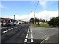
The main street in Nettlesworth
This is looking west along Park View, part of the B6312 which runs through the village from Sacriston, to the main A167 a short distance west of here. Most of the village housing is of fairly recent origins, as shown here. The village was created as miners houses in the mid 19th century, but there was an earlier one dating back to medieval times. However, it wasn't on this site, but a couple of kilometres to the west, near present day Sacriston.
Image: © Robert Graham
Taken: 23 Sep 2019
0.12 miles
3
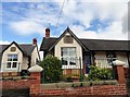
Plaque on the Aged Miners Homes at Nettlesworth
The plaque states that these were built in 1926, the year of the great strike. Nettlesworth is a former mining village, and these are typical of such villages in County Durham.
Image: © Robert Graham
Taken: 23 Sep 2019
0.18 miles
4
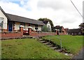
Aged Miners Homes, Nettlesworth
This terrace is on Park View, the main street through the village. The present village of Nettlesworth was created as a mining community in the 19th century. Aged Miners Homes were a feature of mining villages in County Durham, mostly built in the first half of the 20th century. These ones date from 1926.
Image: © Robert Graham
Taken: 23 Sep 2019
0.19 miles
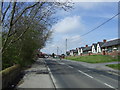
6
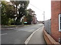
Road to Kimblesworth
From the neighbouring village of Nettlesworth, at the junction on Park View. These two little ex mining villages are of 19th origin, although they do have medieval roots.
Image: © Robert Graham
Taken: 23 Sep 2019
0.22 miles