IMAGES TAKEN NEAR TO
Railway Cottages, DURHAM, DH1 4JB
Introduction
This page details the photographs taken nearby to Railway Cottages, DH1 4JB by members of the Geograph project.
The Geograph project started in 2005 with the aim of publishing, organising and preserving representative images for every square kilometre of Great Britain, Ireland and the Isle of Man.

There are currently over 7.5m images from over14,400 individuals and you can help contribute to the project by visiting https://www.geograph.org.uk
Image Map
Images are licensed for reuse under creativecommons.org/licenses/by-sa/2.0
Notes
- Clicking on the map will re-center to the selected point.
- The higher the marker number, the further away the image location is from the centre of the postcode.
Image Listing (16 Images Found)
Images are licensed for reuse under creativecommons.org/licenses/by-sa/2.0
Image
Details
Distance
1
Newcastle Road (A167), Durham
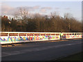
This is where the A167 crosses the east coast main line. After the Selby rail disaster, the authorities, at no doubt enormous expense, put in crash barriers to guard against the highly unlikely event of runaway vehicles crashing down into the very deep cutting below. At first, the barriers were painted plain blue, but then somebody in authority decided to jazz them up a bit, so they are now very colourful indeed.
Image: © Oliver Dixon
Taken: 18 Feb 2006
0.10 miles
2
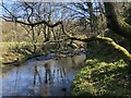
River Browney near Relly Mill Viaduct
Image: © David Robinson
Taken: 27 Mar 2022
0.11 miles
3
Relly Mill Viaduct
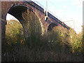
Where the East Coast main line crosses the deep valley of the River Browney, just to the south-west of Durham city. The viaduct stands over the original Relly Mill. Underneath the far arch of the viaduct is the remains of the abutment of the original wooden viaduct of the Bishop Auckland Branch (additional information supplied by Craig Oliphant).
Image: © Oliver Dixon
Taken: 18 Feb 2006
0.12 miles
4
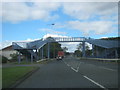
Footbridge over the A167 at Crossgate Moor in Durham City
Image: © Peter Robinson
Taken: 19 Sep 2012
0.14 miles
5
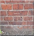
Ordnance Survey Cut Mark
This OS cut mark can be found on the NE parapet of the railway bridge, Newcastle Road. It marks a point 99.429m above mean sea level.
Image: © Adrian Dust
Taken: 14 Sep 2018
0.14 miles
6
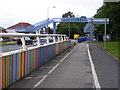
Newcastle Road Footbridge
The A167 at Neville's Cross.
Image: © Gordon Griffiths
Taken: 28 Jun 2008
0.15 miles
8
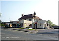
Sainsbury's Local supermarket, Crossgate Moor
On Newcastle Road.
Image: © JThomas
Taken: 4 Jun 2016
0.19 miles
9
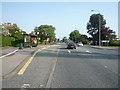
Bus stop and shelter on Newcastle Road, Crossgate Moor
Image: © JThomas
Taken: 4 Jun 2016
0.19 miles