
IMAGES TAKEN NEAR TO
Crossgate Moor, DURHAM, DH1 4HR
Introduction
This page details the photographs taken nearby to DH1 4HR by members of the Geograph project.
The Geograph project started in 2005 with the aim of publishing, organising and preserving representative images for every square kilometre of Great Britain, Ireland and the Isle of Man.

There are currently over 7.5m images from over14,400 individuals and you can help contribute to the project by visiting https://www.geograph.org.uk
Image Map
Images are licensed for reuse under creativecommons.org/licenses/by-sa/2.0
Notes
- Clicking on the map will re-center to the selected point.
- The higher the marker number, the further away the image location is from the centre of the postcode.
Image Listing (8 Images Found)
Images are licensed for reuse under creativecommons.org/licenses/by-sa/2.0
Image
Details
Distance
1
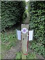
Northern Saints Trails waymark
This is the reverse view of https://www.geograph.org.uk/photo/7308497
The reverse side requests dog walkers to clear up after their dogs.
Image: © Russel Wills
Taken: 4 Oct 2022
0.22 miles
2
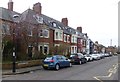
Fieldhouse Terrace
Western Hill, Durham.
Image: © Russel Wills
Taken: 12 Mar 2016
0.23 miles
3
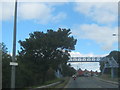
Footbridge over the A167 at Redhills in Durham City
Image: © Peter Robinson
Taken: 19 Sep 2012
0.23 miles
4
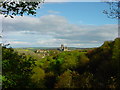
Flass Vale
The east-facing slope of Flass Vale is covered with oak trees, holly and elder with some patches of sycamore. Oak and sycamore cover the west-facing slope.
The Flass Vale is a natural refuge for plants and animals. It also affords open SE views down the Vale toward Durham Cathedral and Durham Castle.
Image: © Harry Wilson
Taken: 29 Apr 2002
0.23 miles
5
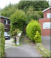
Footpath between the houses
Part of the Northern Saints Trails.
http://northernsaints.com/
Image: © Russel Wills
Taken: 4 Oct 2022
0.23 miles
6
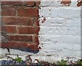
Ordnance Survey Cut Mark
This OS cut mark can be found on No1 Newcastle Road. It marks a point 97.966m above mean sea level.
Image: © Adrian Dust
Taken: 14 Sep 2018
0.25 miles
7
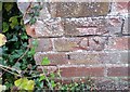
Ordnance Survey Cut Mark
This OS cut mark can be found on the wall at the junction of Redhills Lane & St Aidans Crescent. It marks a point 106.052m above mean sea level.
Image: © Adrian Dust
Taken: 14 Sep 2018
0.25 miles
8
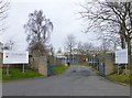
Entrance to St Leonard's Catholic School
North End, Durham DH1 4NG.
http://www.st-leonards.durham.sch.uk/
Image: © Russel Wills
Taken: 12 Mar 2016
0.25 miles