1
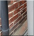
Construction of Sheraton House, student residence, Durham
Sheraton House will have 191 bedrooms. Also part of Sheraton Park is the existing Neville House, being renovated to provide 227 bedrooms. The site was part of New College of the University of Durham.
Image: © David Hawgood
Taken: 11 Sep 2016
0.02 miles
2
Faraday Court, off Clay Lane, Durham
A street of modern houses.
Image: © David Hawgood
Taken: 11 Sep 2016
0.03 miles
3
Ustinov College, Durham
Ustinov is exclusively for post-graduate students and is Durham University's largest college. The building was originally built for Neville's Cross College in the 1920s, becoming New College Durham upon merging with Durham Technical College in 1977 and ceasing to be part of the university. New College Durham re-developed their Framwellgate site and moved out in 2004. Ustinov College re-located to the current site in 2017.
Image: © David Robinson
Taken: 27 Mar 2022
0.05 miles
4
Dalton Crescent, Neville's Cross, Durham
A crescent of modern town houses, just off the former A1.
Image: © David Hawgood
Taken: 11 Sep 2016
0.08 miles
5
Clay Lane, Durham
This part of the lane is a public footpath which continues beside Durham School playing fields and across pasture down to Quarryheads Lane.
Image: © David Hawgood
Taken: 11 Sep 2016
0.09 miles
6
Ordnance Survey Cut Mark
This OS cut mark can be found on No9 Darlington Road. It marks a point 95.710m above mean sea level.
Image: © Adrian Dust
Taken: 14 Sep 2018
0.13 miles
7
Sheraton Park Sports Field
Image: © Roger Smith
Taken: 16 Sep 2007
0.13 miles
8
Modern housing in Durham city
Virtually all of the houses in this view from Archers' Rise are modern. The district is close to Neville's Cross and is probably part of it, lying south-west of the city centre, the cathedral and the castle.
Image: © Trevor Littlewood
Taken: 25 Jan 2016
0.13 miles
9
The Duke of Wellington, Darlington Road
Image: © Des Blenkinsopp
Taken: 27 Aug 2022
0.14 miles
10
The Duke Of Wellington public house, Durham
An Ember Inn on Darlington Road.
Image: © JThomas
Taken: 28 Nov 2015
0.14 miles


