
IMAGES TAKEN NEAR TO
NEWTON STEWART, DG8 7AS
Introduction
This page details the photographs taken nearby to DG8 7AS by members of the Geograph project.
The Geograph project started in 2005 with the aim of publishing, organising and preserving representative images for every square kilometre of Great Britain, Ireland and the Isle of Man.

There are currently over 7.5m images from over14,400 individuals and you can help contribute to the project by visiting https://www.geograph.org.uk
Image Map
Images are licensed for reuse under creativecommons.org/licenses/by-sa/2.0
Notes
- Clicking on the map will re-center to the selected point.
- The higher the marker number, the further away the image location is from the centre of the postcode.
Image Listing (12 Images Found)
Images are licensed for reuse under creativecommons.org/licenses/by-sa/2.0
Image
Details
Distance
2
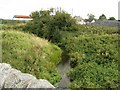
The Lane from Parkmaclurg Bridge
In this case "The Lane" is a small burn. Parkmaclurg farm buildings in the distance.
Image: © James Bell
Taken: 10 Sep 2010
0.05 miles
4
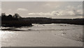
Tidal bore, Cree estuary
A small tidal bore on the Cree, seen from near Roadfoot about 2 hours before high tide on one of the largest spring tides for about 20 years.
Image: © David Baird
Taken: 21 Feb 2015
0.12 miles
5
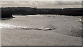
Tidal bore, Cree estuary
A small tidal bore on the Cree, seen from near Roadfoot about 2 hours before high tide on one of the largest spring tides for about 20 years.
Image: © David Baird
Taken: 21 Feb 2015
0.12 miles
7
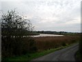
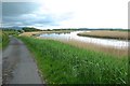
Bend in the River Cree and the Carse of Barr
taken from the entrance to Parkmaclurg at high tide
Image: © Kirsty Smith
Taken: 18 Oct 2005
0.15 miles
8
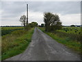
Road to Parkmaclurg
This small lane leads down to Parkmaclurg Farm, Roadfoot right of picture and the River Cree estuary.
Image: © Andy Farrington
Taken: 14 Oct 2010
0.22 miles
9
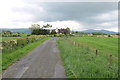
Towards Roadfoot
Near the Cree estuary
Image: © Anthony O'Neil
Taken: 19 May 2019
0.23 miles
10
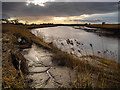
The River Cree near Roadfoot
With a spring tide and a southwesterly gale, the Cree estuary can sometimes have a tidal bore, apparently best seen on this stretch near Roadfoot approximately 2 hours before high water. With what sounded like ideal conditions, I waited here for about 40 minutes and was eventually rewarded with a wave so small that I wasn't even sure it had happened until I noticed the current had reversed flow. Ah well - maybe I'll have better luck next time!
Image: © David Baird
Taken: 2 Feb 2014
0.23 miles