IMAGES TAKEN NEAR TO
Dalry, CASTLE DOUGLAS, DG7 3SL
Introduction
This page details the photographs taken nearby to DG7 3SL by members of the Geograph project.
The Geograph project started in 2005 with the aim of publishing, organising and preserving representative images for every square kilometre of Great Britain, Ireland and the Isle of Man.

There are currently over 7.5m images from over14,400 individuals and you can help contribute to the project by visiting https://www.geograph.org.uk
Image Map
Images are licensed for reuse under creativecommons.org/licenses/by-sa/2.0
Notes
- Clicking on the map will re-center to the selected point.
- The higher the marker number, the further away the image location is from the centre of the postcode.
Image Listing (14 Images Found)
Images are licensed for reuse under creativecommons.org/licenses/by-sa/2.0
Image
Details
Distance
1
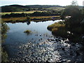
The confluence of the Polharrow Burn and Water of Ken.
Image: © Bob Peace
Taken: 23 Aug 2008
0.10 miles
2
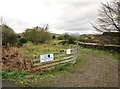
The entrance to Inverharrow
According to the notice, this is a recently built house.
Image: © Ann Cook
Taken: 12 May 2013
0.11 miles
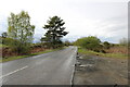
4
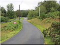
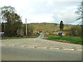
Minor road joining A713 to the south of Polharrow Bridge
Looking north-eastward.
Image: © Peter Wood
Taken: 12 Sep 2017
0.13 miles
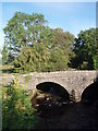
5
Polharrow Bridge
This bridge, which carries the A713 across the Polharrow Burn at the point where the burn flows into the Water of Ken, is well hidden by trees but can just be made out. The photo was taken from the minor road which leads to Forrest Lodge.
Image: © David Purchase
Taken: 30 Oct 2018
0.13 miles
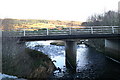
6
Polharrow Bridge
This beautiful stone bridge has now been replaced with a faceless concrete structure - see other image.
Image: © Bob Peace
Taken: 23 Aug 2008
0.17 miles
8
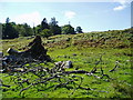
The site of Pluckham's Inn on the Polmaddy Pack Road
This beech tree which has stood for hundreds of years marked the site of Pluckham's Inn. The tree fell in a recent gale.
Image: © Bob Peace
Taken: 8 Sep 2007
0.21 miles
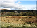
9
The A713 to Carsphairn and Ayr
From near Earlstoun Loch.
Image: © Billy McCrorie
Taken: 13 May 2021
0.21 miles