IMAGES TAKEN NEAR TO
Borgue, KIRKCUDBRIGHT, DG6 4SG
Introduction
This page details the photographs taken nearby to DG6 4SG by members of the Geograph project.
The Geograph project started in 2005 with the aim of publishing, organising and preserving representative images for every square kilometre of Great Britain, Ireland and the Isle of Man.

There are currently over 7.5m images from over14,400 individuals and you can help contribute to the project by visiting https://www.geograph.org.uk
Image Map
Images are licensed for reuse under creativecommons.org/licenses/by-sa/2.0
Notes
- Clicking on the map will re-center to the selected point.
- The higher the marker number, the further away the image location is from the centre of the postcode.
Image Listing (19 Images Found)
Images are licensed for reuse under creativecommons.org/licenses/by-sa/2.0
Image
Details
Distance
1
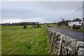
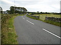
Pringleton House
View along the B727 in the direction of Borgue.
Image: © Andy Farrington
Taken: 22 Jan 2014
0.03 miles
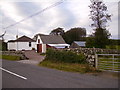
3
Roadway towards Pringleton House
B727 road towards Borgue village.
Image: © James Bell
Taken: 2 Sep 2010
0.04 miles
4
Sheepfold at Culraven
At the side of the B727 across the road from the farm.
Image: © Andy Farrington
Taken: 22 Jan 2014
0.06 miles
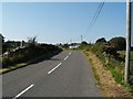
5
The B727 approaching Culraven Farm
The road just cuts the corner of the gridsquare.
Image: © Phil Catterall
Taken: 28 Sep 2007
0.07 miles
6
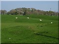
Sheep, Culraven
The hummocks are places with thin soils, the rock is not far below the surface.
Image: © Richard Webb
Taken: 21 Apr 2019
0.08 miles
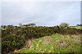
7
Fields by Culraven
View north towards Pringleton House by the B727.
Image: © Andy Farrington
Taken: 22 Jan 2014
0.09 miles
8
Fields south of Pringleton House
View north towards the property by the B727.
Image: © Andy Farrington
Taken: 22 Jan 2014
0.09 miles
9
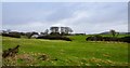
Culraven Farm
View across fields towards the farm.
Image: © Andy Farrington
Taken: 22 Jan 2014
0.10 miles
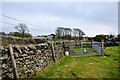
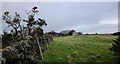
10
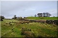
Boundary Wall by Culraven
View north east with the farm tucked away behind the trees on the horizon to the right.
Image: © Andy Farrington
Taken: 22 Jan 2014
0.10 miles