
IMAGES TAKEN NEAR TO
Howgate Street, DUMFRIES, DG2 7AE
Introduction
This page details the photographs taken nearby to Howgate Street, DG2 7AE by members of the Geograph project.
The Geograph project started in 2005 with the aim of publishing, organising and preserving representative images for every square kilometre of Great Britain, Ireland and the Isle of Man.

There are currently over 7.5m images from over14,400 individuals and you can help contribute to the project by visiting https://www.geograph.org.uk
Image Map
Images are licensed for reuse under creativecommons.org/licenses/by-sa/2.0
Notes
- Clicking on the map will re-center to the selected point.
- The higher the marker number, the further away the image location is from the centre of the postcode.
Image Listing (264 Images Found)
Images are licensed for reuse under creativecommons.org/licenses/by-sa/2.0
Image
Details
Distance

3
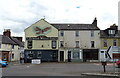
The Spread Eagle Inn, Dumfries
Beside the A780.
Image: © JThomas
Taken: 22 May 2021
0.04 miles
4
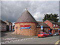
Brigend Theatre
Doors Open Day 2008 at the Brigend Theatre, Dumfries. Converted into a 92 seat theatre in 1972 from the former Maxwelltown Scottish Episcopal church for the Dumfries Musical Theatre Company.
Image: © Chris Newman
Taken: 28 Sep 2008
0.04 miles
5
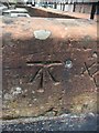
OS Cut Mark: Dumfries, Wall, No 1 Terregles Street
Ordnance Survey - Cut Mark: Dumfries, Wall, No 1 Terregles Street
Image: © thejackrustles
Taken: 4 May 2019
0.05 miles
6
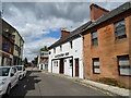
The Salutation Inn, Dumfries
On Market Square.
Image: © JThomas
Taken: 22 May 2021
0.05 miles
8
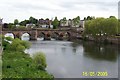
Old bridge at Dumfries
From Scotland holiday
Image: © Tom Hooper
Taken: 17 Aug 2005
0.06 miles
9

Old bridge and weir
One of Scotland's oldest surviving bridges spans the River Nith. The present sandstone bridge (on the site of an earlier one built by the Lady Devorgilla) dates from around 1430, but was reconstructed after flood damage in 1620 and reduced from nine to six arches in 1794 after the river had been narrowed by land reclamation to create the Whitesands, from where this picture was taken. http://www.undiscoveredscotland.co.uk/dumfries/devorgillabridge/index.html
Image: © Fractal Angel
Taken: 13 Oct 2012
0.06 miles
10
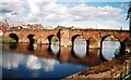
Devorgilla Bridge (c. 15th Century)- Dumfries
This was taken on a rare bright, sunny day, from the old Maxwelltown side of the River Nith.
Image: © John Jardine
Taken: 15 Aug 1999
0.07 miles