Old bridge and weir
Introduction
The photograph on this page of Old bridge and weir by Fractal Angel as part of the Geograph project.
The Geograph project started in 2005 with the aim of publishing, organising and preserving representative images for every square kilometre of Great Britain, Ireland and the Isle of Man.

There are currently over 7.5m images from over 14,400 individuals and you can help contribute to the project by visiting https://www.geograph.org.uk
Old bridge and weir
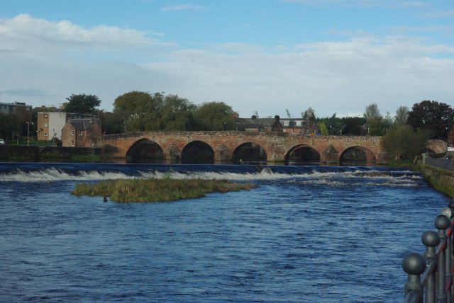
Image: © Fractal Angel Taken: 13 Oct 2012
One of Scotland's oldest surviving bridges spans the River Nith. The present sandstone bridge (on the site of an earlier one built by the Lady Devorgilla) dates from around 1430, but was reconstructed after flood damage in 1620 and reduced from nine to six arches in 1794 after the river had been narrowed by land reclamation to create the Whitesands, from where this picture was taken. http://www.undiscoveredscotland.co.uk/dumfries/devorgillabridge/index.html
Images are licensed for reuse under creativecommons.org/licenses/by-sa/2.0
Image Location
Latitude
55.068604
Longitude
-3.617614