IMAGES TAKEN NEAR TO
Holywood, DUMFRIES, DG2 0RQ
Introduction
This page details the photographs taken nearby to DG2 0RQ by members of the Geograph project.
The Geograph project started in 2005 with the aim of publishing, organising and preserving representative images for every square kilometre of Great Britain, Ireland and the Isle of Man.

There are currently over 7.5m images from over14,400 individuals and you can help contribute to the project by visiting https://www.geograph.org.uk
Image Map
Images are licensed for reuse under creativecommons.org/licenses/by-sa/2.0
Notes
- Clicking on the map will re-center to the selected point.
- The higher the marker number, the further away the image location is from the centre of the postcode.
Image Listing (2 Images Found)
Images are licensed for reuse under creativecommons.org/licenses/by-sa/2.0
Image
Details
Distance
1
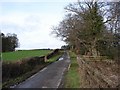
Loch Foot Burn Bridge
The Abbey-Killylung X-Rds lane crosses the small Loch Foot Burn Bridge. East Crossleys Farm is just visible (mid left) on the adjacent lane.
Image: © Chris Newman
Taken: 24 Feb 2008
0.08 miles
2
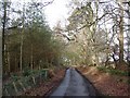
East Crossleys Woodlands
Winter view along the Abbey to Killylung X-Rds lane.
Image: © Chris Newman
Taken: 24 Feb 2008
0.19 miles