
IMAGES TAKEN NEAR TO
St. Michael Street, DUMFRIES, DG1 2QQ
Introduction
This page details the photographs taken nearby to St. Michael Street, DG1 2QQ by members of the Geograph project.
The Geograph project started in 2005 with the aim of publishing, organising and preserving representative images for every square kilometre of Great Britain, Ireland and the Isle of Man.

There are currently over 7.5m images from over14,400 individuals and you can help contribute to the project by visiting https://www.geograph.org.uk
Image Map
Images are licensed for reuse under creativecommons.org/licenses/by-sa/2.0
Notes
- Clicking on the map will re-center to the selected point.
- The higher the marker number, the further away the image location is from the centre of the postcode.
Image Listing (241 Images Found)
Images are licensed for reuse under creativecommons.org/licenses/by-sa/2.0
Image
Details
Distance
1
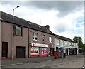
Post Office and shop on St Michael Street (B725), Dumfries
Showing position of Postbox No. DG1 23.
See Image] for postbox.
Image: © JThomas
Taken: 22 May 2021
0.02 miles
2
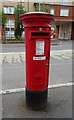
Elizabethan postbox on St Michael Street, Dumfries
Postbox No. DG1 23.
See Image] for context.
Image: © JThomas
Taken: 22 May 2021
0.02 miles
3

Advert at St Michael's Services garage
Nith Inshore Rescue is an independent lifeboat serving the Dumfries area. We are based in Glencaple, 5 miles south of Dumfries in south-west Scotland, on the estuary of the River Nith close to where it joins the Solway Firth.
Image: © Russel Wills
Taken: 30 Sep 2021
0.04 miles
5
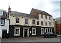
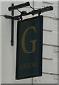
Greens public house, Dumfries
On St Michael Street (B725).
Image: © JThomas
Taken: 22 May 2021
0.05 miles
7
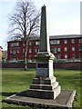
Titanic Memorial, Dumfries
Titanic Memorial in Dock Park (Port of Dumfries) commemorates two natives of Dumfries who were employed by the White Star Line; a steward and a musician band who died at the sinking of the Titanic on the night of 14 April 1912.
Image: © Chris Newman
Taken: 27 Mar 2008
0.05 miles
8
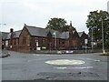
St Michael's Primary School
Originally, the school began as a Church School attached to the South Free Territorial Church. The school opened in 1865 and provided a general education - including Latin, for some pupils.
'At St Michael’s Primary we aim to provide a secure, supportive and friendly environment in which the children will develop skills and experiences, which will allow them to reach their full potential.' https://stmichaelsdumfries.dumgal.sch.uk/
Image: © Russel Wills
Taken: 30 Sep 2021
0.06 miles
9
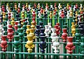
Thistle maze, Dock Park
For a wider view, see Image .
We would be interested to know when this was made - it's quite a work of art.
Image: © Rose and Trev Clough
Taken: 9 Jun 2012
0.08 miles
10
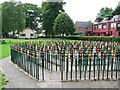
Maze and cafe, Dock Park
Before it was developed in Victorian times as a place for public recreation, Dock Park was a cattle park or meadow on the flood plain of the River Nith http://www.dumgal.gov.uk/index.aspx?articleid=9060 .
Click for closer view of Image .
Image: © Rose and Trev Clough
Taken: 9 Jun 2012
0.08 miles