
IMAGES TAKEN NEAR TO
Buccleuch Street, DUMFRIES, DG1 2AN
Introduction
This page details the photographs taken nearby to Buccleuch Street, DG1 2AN by members of the Geograph project.
The Geograph project started in 2005 with the aim of publishing, organising and preserving representative images for every square kilometre of Great Britain, Ireland and the Isle of Man.

There are currently over 7.5m images from over14,400 individuals and you can help contribute to the project by visiting https://www.geograph.org.uk
Image Map
Images are licensed for reuse under creativecommons.org/licenses/by-sa/2.0
Notes
- Clicking on the map will re-center to the selected point.
- The higher the marker number, the further away the image location is from the centre of the postcode.
Image Listing (402 Images Found)
Images are licensed for reuse under creativecommons.org/licenses/by-sa/2.0
Image
Details
Distance
1
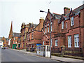
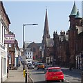
Buccleuch Street, Dumfries
Red sandstone buildings in the centre of Dumfries.
Image: © Richard Dorrell
Taken: 19 Mar 2010
0.01 miles
2
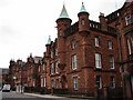
Dumfries Sheriff Court
The Sheriff Court in Buccleuch St (1863-6) is a tall Baronial red sandstone building; the central pepperpot turret has cannon spouts. The C20 extension court building (next up from the Sheriff Court) is much plainer.
Image: © Chris Newman
Taken: 6 Jul 2008
0.02 miles
3
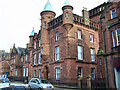
Dumfries Sheriff Court
Located in Buccleuch Street, built 1866
Image: © Richard Dorrell
Taken: 19 Mar 2010
0.02 miles
4
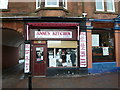
Anne's Kitchen, Dumfries
Picture of this cafe in Friars Vennel.
Image: © Andy Farrington
Taken: 23 Dec 2010
0.03 miles
6
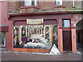
Friars Vennel, Dumfries
Shop front mural depicting the story of Grey Friars Monastery Image
Image: © Andy Farrington
Taken: 23 Dec 2010
0.03 miles
7
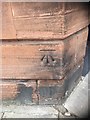
OS Cut Mark: Dumfries, No 27 Buccleuch Street
Ordnance Survey Cut Mark: Dumfries, No 27 Buccleuch Street
Image: © thejackrustles
Taken: 4 May 2019
0.04 miles
8
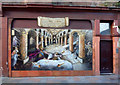
Towards Scottish Independence
The board above this attractive mural reads:
FRIARS VENNEL ONCE THE SITE OF
GREYFRIARS MONASTRY WHERE IN 1300
ROBERT THE BRUCE
SLEW THE RED COMYN AIDED BY SIR ROGER
KIRKPATRICK AND OPENED THE FINAL STAGE FOR
SCOTTISH INDEPENDENCE WHICH ENDED
VICTORIOUSLY AT BANNOCKBURN 1314
‘I MAK SICCAR’
It's reassuring to know that the 2014 version of the quest for Scottish independence will be done through the ballot box, not by the sword!
Image: © Mary and Angus Hogg
Taken: 29 Oct 2013
0.04 miles
9
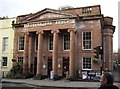
Robert the Bruce
Robert the Bruce public house, which has been converted from an old church.
Image: © Colin Kinnear
Taken: 30 Jan 2008
0.04 miles
10
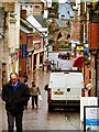
View from Irish Street
The view here is over Brewery Street to White Sands the A781, then the Old Bridge over the River Nith and finally to Maxwell Street on the other side of the river with the parked cars. The weather as can be seen by coats and hats was pretty dreich as they say in this part of the world. Lucky for me I got most of my pictures taken before the rain set in for the rest of the day in Dumfries but found that it had snowed when I got back home to the Machars.
Image: © Andy Farrington
Taken: 26 Jan 2012
0.04 miles