
IMAGES TAKEN NEAR TO
ANNAN, DG12 5RB
Introduction
This page details the photographs taken nearby to DG12 5RB by members of the Geograph project.
The Geograph project started in 2005 with the aim of publishing, organising and preserving representative images for every square kilometre of Great Britain, Ireland and the Isle of Man.

There are currently over 7.5m images from over14,400 individuals and you can help contribute to the project by visiting https://www.geograph.org.uk
Image Map
Images are licensed for reuse under creativecommons.org/licenses/by-sa/2.0
Notes
- Clicking on the map will re-center to the selected point.
- The higher the marker number, the further away the image location is from the centre of the postcode.
Image Listing (12 Images Found)
Images are licensed for reuse under creativecommons.org/licenses/by-sa/2.0
Image
Details
Distance
3
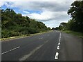
Howes
Fields west of Annan. About time we saw some more of this square other than the A75 through a windscreen, even though this too is a road shot.
Image: © Richard Webb
Taken: 27 Jul 2016
0.09 miles
6
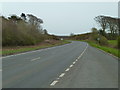
A75 north of Annan
Looking towards Gretna and the M6.
Image: © Andy Farrington
Taken: 3 Apr 2012
0.22 miles
8
B723 overbridge north of Annan
A75 eastbound
Image: © John Firth
Taken: 19 May 2013
0.23 miles
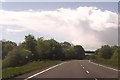
10
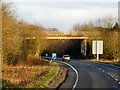
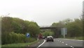
B723 Flyover A75
Bridge taking the B723 over the eastbound A75 near Annan.
Image: © David Dixon
Taken: 14 Feb 2013
0.24 miles