
IMAGES TAKEN NEAR TO
Boreland, LOCKERBIE, DG11 2LL
Introduction
This page details the photographs taken nearby to DG11 2LL by members of the Geograph project.
The Geograph project started in 2005 with the aim of publishing, organising and preserving representative images for every square kilometre of Great Britain, Ireland and the Isle of Man.

There are currently over 7.5m images from over14,400 individuals and you can help contribute to the project by visiting https://www.geograph.org.uk
Image Map
Images are licensed for reuse under creativecommons.org/licenses/by-sa/2.0
Notes
- Clicking on the map will re-center to the selected point.
- The higher the marker number, the further away the image location is from the centre of the postcode.
Image Listing (28 Images Found)
Images are licensed for reuse under creativecommons.org/licenses/by-sa/2.0
Image
Details
Distance
1
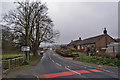
Boreland village
The village lies on the B723, about seven miles north-east of Lockerbie.
Image: © Richard Dorrell
Taken: 9 Mar 2014
0.01 miles
2
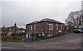
Hutton Primary School, Boreland
Built 1857 and extended 1906, the school currently has a roll of 21 children.
Image: © Richard Dorrell
Taken: 9 Mar 2014
0.02 miles
3
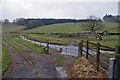
Gated ford
Through the gate, a ford in the track crosses the Boreland Burn.
Image: © Richard Dorrell
Taken: 9 Mar 2014
0.03 miles
4
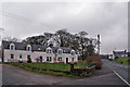
Cottages in Boreland
Boreland village lies on the B723 about seven miles north-east of Lockerbie.
Image: © Richard Dorrell
Taken: 9 Mar 2014
0.04 miles
5
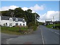
Boreland
One of the few settlements around these parts, Boreland is in Dryfesdale about 12km upstream from Lockerbie.
Image: © Richard Webb
Taken: 8 Oct 2015
0.05 miles
6
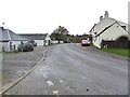
Lockerbie Road at Boreland
The B723 at the lower end of the village.
Image: © Oliver Dixon
Taken: 14 Oct 2018
0.06 miles
7
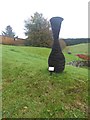
Commemorative vase at Boreland
Vase made of slate and standing about 2 metres high, commemorating the 90th birthday of Her Majesty the Queen, 11 June 2016.
Image: © Oliver Dixon
Taken: 14 Oct 2018
0.06 miles
8
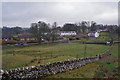
Walled fields at Boreland
The village stands on the B723 between Lockerbie and Eskdalemuir.
Image: © Richard Dorrell
Taken: 9 Mar 2014
0.06 miles
9
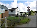
Telephone exchange, Boreland
An update on the original exchange, two doors down.Image
Image: © Richard Webb
Taken: 8 Oct 2015
0.12 miles
10
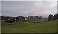
Pastureland at Boreland
Beyond, the Boreland Burn meanders in a shallow valley.
Image: © Richard Dorrell
Taken: 9 Mar 2014
0.12 miles