IMAGES TAKEN NEAR TO
Dryfe Road, LOCKERBIE, DG11 2AP
Introduction
This page details the photographs taken nearby to Dryfe Road, DG11 2AP by members of the Geograph project.
The Geograph project started in 2005 with the aim of publishing, organising and preserving representative images for every square kilometre of Great Britain, Ireland and the Isle of Man.

There are currently over 7.5m images from over14,400 individuals and you can help contribute to the project by visiting https://www.geograph.org.uk
Image Map
Images are licensed for reuse under creativecommons.org/licenses/by-sa/2.0
Notes
- Clicking on the map will re-center to the selected point.
- The higher the marker number, the further away the image location is from the centre of the postcode.
Image Listing (27 Images Found)
Images are licensed for reuse under creativecommons.org/licenses/by-sa/2.0
Image
Details
Distance
1
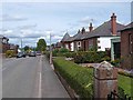
Bungalows on Dryfe Road
On the B723 to Eskdale.
Image: © Oliver Dixon
Taken: 31 Jul 2013
0.03 miles
2
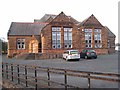
Old school buildings, Lockerbie
Although obviously still in use for public purposes, it is not clear whether this building is still part of the Lockerbie Academy, whose new buildings can be seen at Image
Image: © Oliver Dixon
Taken: 11 Oct 2008
0.04 miles
3
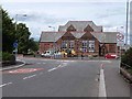
Old school buildings, Lockerbie
Little seems to have changed since my last visit in 2008 Image The forecourt seems to be used as an informal council yard.
Image: © Oliver Dixon
Taken: 31 Jul 2013
0.08 miles
4
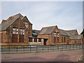
Dryfesdale School, Lockerbie
Viewed looking across Dryfe Road from its junction with Harcourt Place. The school was established in 1875, but the building is currently closed.
Image: © Richard Dorrell
Taken: 4 Mar 2013
0.08 miles
5
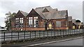
Former Dryfesdale Public Old School viewed from Dryfe Road
The site is currently being developed as Lockerbie Old School community hub, https://www.lockerbieoldschool.org/history/
The building previously had a belfry which was an Ordnance Survey intersected station trig point, https://trigpointing.uk/trig/9926
Image: © Roger Templeman
Taken: 24 Oct 2023
0.08 miles
6
Houses on Glasgow Road
Take on a misty autumn morning.
Image: © JThomas
Taken: 15 Sep 2021
0.08 miles
7
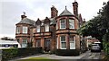
Nos 5 and 3 Glasgow Road
Ordnance Survey documents indicate that a benchmark levelled at 77.684m above Newlyn Datum was verified in 1972 near the front right hand corner of the right hand house. The mark is probably still there behind the hedge
Image: © Roger Templeman
Taken: 24 Oct 2023
0.08 miles
8
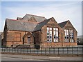
Dryfesdale School, Lockerbie
Located at the junction of Glasgow Road and Dryfe Road, and facing down Townhead Street, the school was established in October 1875. The building is now closed.
Image: © Richard Dorrell
Taken: 4 Mar 2013
0.09 miles
9
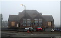
Dryfesdale School, Lockerbie
Now closed and being converted into a community resouce.
Image: © JThomas
Taken: 15 Sep 2021
0.09 miles