1
Spiral footbridge, Ilkeston
Replacing the original footpath between Hallcroft Road and Vincent Road which was cut when Chalons Way was constructed.
Image: © Alan Murray-Rust
Taken: 11 Aug 2017
0.02 miles
2
The old churchyard, Ilkeston
Created in the 19th century as an extension to the churchyard attached to St Mary's Church, it was cut off when Chalons Way was constructed. It is now general open space, although parts are substantially overgrown.
Image: © Alan Murray-Rust
Taken: 11 Aug 2017
0.03 miles
3
Chalons Way, Ilkeston
Ilkeston's inner by-pass. The growth of trees conceals the fact that this road cuts right through the urban area. In the distance can be seen the Grade II* Listed Bennerley Viaduct http://www.geograph.org.uk/search.php?i=75745420&page=1&displayclass=slide across the Erewash Valley.
Image: © Alan Murray-Rust
Taken: 11 Aug 2017
0.04 miles
4
Rutland Mill, Ilkeston
Late 19th century three storey lace/hosiery factory erected for C & F Sudbury. Now adaptively reused for a variety of uses. This view round the back shows a freestanding stepped octagonal chimney on a square plinth.
Image: © Chris Allen
Taken: 18 May 2013
0.07 miles
5
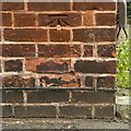
Bench mark, former Anchor Inn, Market Street, Ilkeston
See http://www.geograph.org.uk/photo/5497556 for location and details.
Image: © Alan Murray-Rust
Taken: 11 Aug 2017
0.08 miles
6
Rutland Mill, Ilkeston
Late 19th century three storey lace/hosiery factory erected for C & F Sudbury. Now adaptively reused for a variety of uses. This shows the ornate doorway and pediment above.
Image: © Chris Allen
Taken: 18 May 2013
0.08 miles
7
Rutland Mill, Ilkeston
Late 19th century three storey hosiery factory erected for C & F Sudbury. Now adaptively reused for a variety of uses.
Image: © Chris Allen
Taken: 18 May 2013
0.08 miles
8
Rutland Mills, Market Street
Built in 1881 as a hosiery and glove works, now a business centre for small firms.
Image: © Alan Murray-Rust
Taken: 28 Jul 2017
0.08 miles
9
Rutland Mill, Ilkeston
Late 19th century three storey lace/hosiery factory erected for C & F Sudbury. Now adaptively reused for a variety of uses.
Image: © Chris Allen
Taken: 18 May 2013
0.08 miles
10
Former Anchor Inn, Market Street, Ilkeston
Built in 1859, now converted to flats. It still sports the old anchor used as an inn sign.
Image: © Alan Murray-Rust
Taken: 28 Jul 2017
0.08 miles


