
IMAGES TAKEN NEAR TO
Stonehill, DERBY, DE74 2LZ
Introduction
This page details the photographs taken nearby to Stonehill, DE74 2LZ by members of the Geograph project.
The Geograph project started in 2005 with the aim of publishing, organising and preserving representative images for every square kilometre of Great Britain, Ireland and the Isle of Man.

There are currently over 7.5m images from over14,400 individuals and you can help contribute to the project by visiting https://www.geograph.org.uk
Image Map
Images are licensed for reuse under creativecommons.org/licenses/by-sa/2.0
Notes
- Clicking on the map will re-center to the selected point.
- The higher the marker number, the further away the image location is from the centre of the postcode.
Image Listing (22 Images Found)
Images are licensed for reuse under creativecommons.org/licenses/by-sa/2.0
Image
Details
Distance
1
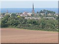
View towards Castle Donington
The spire of St. Edwards Church towers over the village.
Image: © Mat Fascione
Taken: 9 Sep 2007
0.14 miles
2
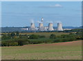
Fields north of East Midlands Airport
Looking towards Ratcliffe on Soar power station, about four miles away.
Image: © Mat Fascione
Taken: 26 Sep 2013
0.18 miles

5
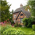
Withybush Farmhouse, High Street, Castle Donington
The main part of the farmhouse to the rear is late 18th century, the timber-framed extension in the foreground being built c.1900, originally a dairy. Listed Grade II.
Image: © Alan Murray-Rust
Taken: 18 Jun 2019
0.23 miles
6

Public footpath off High Street, Castle Donington
Not looking obviously like a public right of way.
Image: © Richard Vince
Taken: 24 Nov 2018
0.24 miles
7

Perimeter fence at East Midlands Airport
The Airport Footpath makes a complete circuit of about 7 miles, at this point the path is on the northern perimeter of the airport.
Image: © Mat Fascione
Taken: 26 Sep 2013
0.24 miles

9
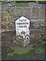
Milepost at Castle Donington
Mid 19th century cast iron milepost situated on High Street and reading 'Castle Donnington Parish' at the top, 'Tamworth 22 Miles' on the left and 'Nottingham 13 Miles' on the right. The oval plaque at the centre shows the makers to be Wootton Bros of Coalville. Note the village name has a double 'n'. In the 19th century Castle Donington was situated on the main Nottingham to Birmingham trunk road, so the mileposts were very important.
Image: © Trevor Rickard
Taken: 23 Jan 2011
0.24 miles
10
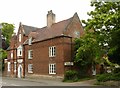
67 High Street, Castle Donington
Early 18th century house, dated 1702 in the brickwork of the gable, although this is not easy to make out. Chequer-pattern Flemish bond brickwork with diaper work in the gable. There is a firemark http://www.geograph.org.uk/photo/6187925 tucked into the far corner by the drainpipe. Listed Grade II.
Image: © Alan Murray-Rust
Taken: 18 Jun 2019
0.24 miles