Milepost at Castle Donington
Introduction
The photograph on this page of Milepost at Castle Donington by Trevor Rickard as part of the Geograph project.
The Geograph project started in 2005 with the aim of publishing, organising and preserving representative images for every square kilometre of Great Britain, Ireland and the Isle of Man.

There are currently over 7.5m images from over 14,400 individuals and you can help contribute to the project by visiting https://www.geograph.org.uk
Milepost at Castle Donington
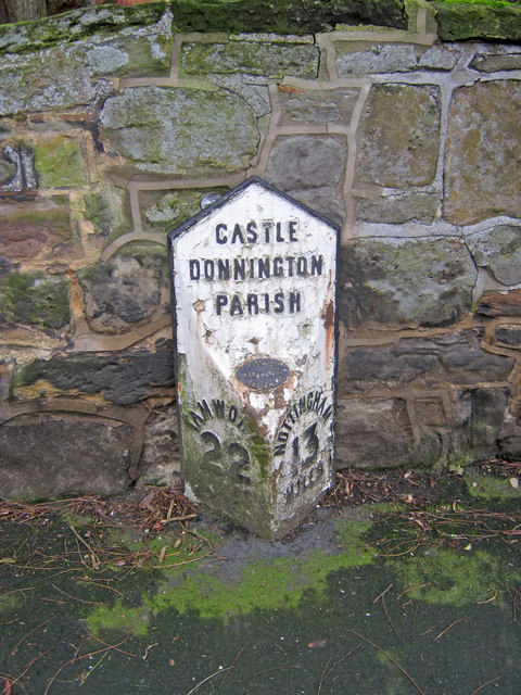
Image: © Trevor Rickard Taken: 23 Jan 2011
Mid 19th century cast iron milepost situated on High Street and reading 'Castle Donnington Parish' at the top, 'Tamworth 22 Miles' on the left and 'Nottingham 13 Miles' on the right. The oval plaque at the centre shows the makers to be Wootton Bros of Coalville. Note the village name has a double 'n'. In the 19th century Castle Donington was situated on the main Nottingham to Birmingham trunk road, so the mileposts were very important.
Images are licensed for reuse under creativecommons.org/licenses/by-sa/2.0
Image Location
Latitude
52.838516
Longitude
-1.343209