
IMAGES TAKEN NEAR TO
Shields Crescent, DERBY, DE74 2JR
Introduction
This page details the photographs taken nearby to Shields Crescent, DE74 2JR by members of the Geograph project.
The Geograph project started in 2005 with the aim of publishing, organising and preserving representative images for every square kilometre of Great Britain, Ireland and the Isle of Man.

There are currently over 7.5m images from over14,400 individuals and you can help contribute to the project by visiting https://www.geograph.org.uk
Image Map
Images are licensed for reuse under creativecommons.org/licenses/by-sa/2.0
Notes
- Clicking on the map will re-center to the selected point.
- The higher the marker number, the further away the image location is from the centre of the postcode.
Image Listing (10 Images Found)
Images are licensed for reuse under creativecommons.org/licenses/by-sa/2.0
Image
Details
Distance
1
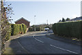
Shields Crescent
A suburban road in the village of Castle Donington.
Image: © Malcolm Neal
Taken: 30 Jan 2019
0.10 miles
2

The junction of Park Lane with Shields Crescent
Image: © Graham Hogg
Taken: 8 Sep 2017
0.11 miles
3
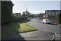
Looking up Park Lane
Another Castle Donington suburban road.
Image: © Malcolm Neal
Taken: 30 Jan 2019
0.13 miles
5
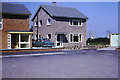
Cordwell Close, Castle Donington
Taken by my father 1966. In the distance are the cooling towers of the old Castle Donington power station
Image: © Arthur Holifield
Taken: Unknown
0.23 miles
6

72 High Street, Castle Donington
Early Georgian house, c.1730-40, Listed Grade II. The garden wall and gateways are separately Listed Grade II http://www.geograph.org.uk/photo/6187936
Image: © Alan Murray-Rust
Taken: 18 Jun 2019
0.24 miles
7
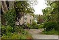
The Cedars, High Street, Castle Donington
Large late Georgian house, c.1830, just showing a glimpse of itself from its former lodge. Listed Grade II.
Image: © Alan Murray-Rust
Taken: 18 Jun 2019
0.25 miles
8
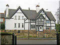
The Key House
Situated on the west side of the High Street. This timber-framed house was built by Thomas Roby in 1636. The two-storey porch at the front (inscribed 1595) was moved from Hall Farm on the other side of the road when it was demolished. Hung in the eaves of the building are actual keys accompanied by inscriptions of initials and dates to indicate various owners and when they carried out improvements - starting at the front above the porch with "TR 1636" and the latest being "FWM 1953 + 2006" around the side.
Image: © Trevor Rickard
Taken: 23 Jan 2011
0.25 miles
9
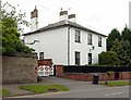
Springhill House, High Street, Castle Donington
Early Victorian house, c.1830-40, Listed Grade II. The garden wall is separately Listed Grade II.
Image: © Alan Murray-Rust
Taken: 18 Jun 2019
0.25 miles
10

Gateway to 72 High Street, Castle Donington
Gatepiers of c.1730-40, with flanking early 19th century walls, Listed Grade II. The cast-iron gates are early 19th century.
Image: © Alan Murray-Rust
Taken: 18 Jun 2019
0.25 miles