
IMAGES TAKEN NEAR TO
Bullhurst Lane, ASHBOURNE, DE6 4PA
Introduction
This page details the photographs taken nearby to Bullhurst Lane, DE6 4PA by members of the Geograph project.
The Geograph project started in 2005 with the aim of publishing, organising and preserving representative images for every square kilometre of Great Britain, Ireland and the Isle of Man.

There are currently over 7.5m images from over14,400 individuals and you can help contribute to the project by visiting https://www.geograph.org.uk
Image Map
Images are licensed for reuse under creativecommons.org/licenses/by-sa/2.0
Notes
- Clicking on the map will re-center to the selected point.
- The higher the marker number, the further away the image location is from the centre of the postcode.
Image Listing (17 Images Found)
Images are licensed for reuse under creativecommons.org/licenses/by-sa/2.0
Image
Details
Distance
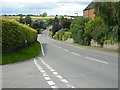
2

Bus stop on Bullhurst Lane, Weston Underwood
Showing position of Postbox No. DE6 480.
See Image] for postbox.
Image: © JThomas
Taken: 21 Aug 2025
0.07 miles
3

Elizabeth II postbox on Bullhurst Lane, Weston Underwood
Postbox No. DE6 480.
See Image] for context.
Image: © JThomas
Taken: 21 Aug 2025
0.08 miles
4

Close up, Elizabeth II postbox on Bullhurst Lane, Weston Underwood
Postbox No. DE6 480.
Image: © JThomas
Taken: 21 Aug 2025
0.08 miles
5
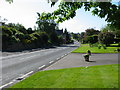
Weston Underwood
View from near the post office looking towards the centre of the village.
Image: © Mike Bardill
Taken: 2 Jun 2006
0.09 miles
6
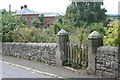
Gate posts of long demolished chapel
Gate posts of long demolished Wesleyan Methodist chapel, with Inn Farm in the background. Note the benchmark, as clean as the day it was cut (1880s?). The stone of the pillars is not local and it seems the wall, beautifully laid, may have replaced the original wall which probably had railings on top of a lower wall. The current wall may be of the stone salvaged when the chapel was demolished. The gate posts themselves may also have been moved, as in an Ordnance Survey map circa 1900 the benchmark appears to indicate the mark round the corner on the main Kedleston to Hulland road.
Image: © Nigel Aspdin
Taken: 17 Aug 2008
0.13 miles
7
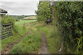
Track off Burland Green Lane
This track leads off Burland Green Lane on the edge of Weston Underwood.
Image: © Malcolm Neal
Taken: 31 Aug 2017
0.14 miles
9
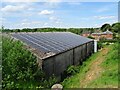
Solar farming at Inn Farm
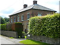
The old farmhouse used to be a coaching inn called the Scarsdale Arms on the main route from Derby to Manchester. Over time, better routes over easier country took traffic away and the inn closed.
Image: © Ian Calderwood
Taken: 5 Jun 2021
0.16 miles
10
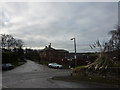
Weston Underwood, lane junction
A substantial farmhouse at the corner.
Image: © Peter Barr
Taken: 12 Dec 2010
0.17 miles