Gate posts of long demolished chapel
Introduction
The photograph on this page of Gate posts of long demolished chapel by Nigel Aspdin as part of the Geograph project.
The Geograph project started in 2005 with the aim of publishing, organising and preserving representative images for every square kilometre of Great Britain, Ireland and the Isle of Man.

There are currently over 7.5m images from over 14,400 individuals and you can help contribute to the project by visiting https://www.geograph.org.uk
Gate posts of long demolished chapel
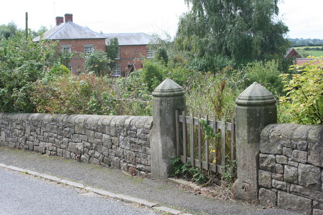
Image: © Nigel Aspdin Taken: 17 Aug 2008
Gate posts of long demolished Wesleyan Methodist chapel, with Inn Farm in the background. Note the benchmark, as clean as the day it was cut (1880s?). The stone of the pillars is not local and it seems the wall, beautifully laid, may have replaced the original wall which probably had railings on top of a lower wall. The current wall may be of the stone salvaged when the chapel was demolished. The gate posts themselves may also have been moved, as in an Ordnance Survey map circa 1900 the benchmark appears to indicate the mark round the corner on the main Kedleston to Hulland road.
Images are licensed for reuse under creativecommons.org/licenses/by-sa/2.0
Image Location
Latitude
52.979863
Longitude
-1.565813