
IMAGES TAKEN NEAR TO
Philipway, ALFRETON, DE55 4JR
Introduction
This page details the photographs taken nearby to Philipway, DE55 4JR by members of the Geograph project.
The Geograph project started in 2005 with the aim of publishing, organising and preserving representative images for every square kilometre of Great Britain, Ireland and the Isle of Man.

There are currently over 7.5m images from over14,400 individuals and you can help contribute to the project by visiting https://www.geograph.org.uk
Image Map
Images are licensed for reuse under creativecommons.org/licenses/by-sa/2.0
Notes
- Clicking on the map will re-center to the selected point.
- The higher the marker number, the further away the image location is from the centre of the postcode.
Image Listing (12 Images Found)
Images are licensed for reuse under creativecommons.org/licenses/by-sa/2.0
Image
Details
Distance
4
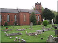
Birchwood Methodist Church, Somercotes
This rather dour redbrick church stands on Birchwood Lane on the edge of Somercotes.
Image: © Stephen McKay
Taken: 7 May 2006
0.17 miles
5
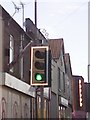
UK Puffin Crossing
UK Puffin Crossing On Nottingham Rd, Somercotes, Alfreton Derbyshire.
Image: © gary
Taken: 14 Jan 2017
0.18 miles
6
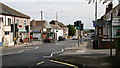
Pedestrian crossing on Somercotes Hill
This photograph was taken from the same location (a bus stop) as the one linked to here Image, the title of which is a reference to a photograph taken for inclusion in the BBC Domesday Project.
For another photograph taken from the same location but looking in the opposite direction, click here: http://www.geograph.org.uk/photo/2437420 .
Image: © Alan Walker
Taken: 1 Jun 2011
0.18 miles
7
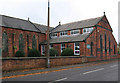
Somercotes - Birchwood Methodist Church hall
On Birchwood Lane. For a fuller view of the church, please see Image
Image: © Dave Bevis
Taken: 31 Oct 2011
0.20 miles
8
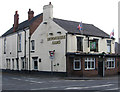
Somercotes - Devonshire Arms
On Nottingham Road.
Image: © Dave Bevis
Taken: 31 Oct 2011
0.20 miles
9
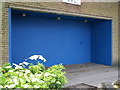
Graffiti no more
The title of this less than inspiring photograph is a reference to the original photograph taken for inclusion in the BBC Domesday Project and now available via the Domesday Reloaded website http://www.bbc.co.uk/history/domesday/dblock/GB-440000-351000/picture/2 .
The location is at the north-western end of Somercotes Hill ( http://www.geograph.org.uk/photo/2437364 ), near the Market Square car park.
This redundant bus shelter has been replaced by a modern one on the edge of the adjacent bus stop ( http://www.geograph.org.uk/photo/2437420 ).
Image: © Alan Walker
Taken: 1 Jun 2011
0.20 miles
10
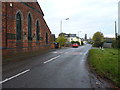
West along Birchwood Road
On the NE side of Somercotes, Birchwood Road leads towards South Normanton. This photo looks back towards Somercotes, and shows a part of the Image
Image: © Richard Law
Taken: 4 Nov 2016
0.20 miles