
IMAGES TAKEN NEAR TO
Charles Street, ALFRETON, DE55 1LZ
Introduction
This page details the photographs taken nearby to Charles Street, DE55 1LZ by members of the Geograph project.
The Geograph project started in 2005 with the aim of publishing, organising and preserving representative images for every square kilometre of Great Britain, Ireland and the Isle of Man.

There are currently over 7.5m images from over14,400 individuals and you can help contribute to the project by visiting https://www.geograph.org.uk
Image Map
Images are licensed for reuse under creativecommons.org/licenses/by-sa/2.0
Notes
- Clicking on the map will re-center to the selected point.
- The higher the marker number, the further away the image location is from the centre of the postcode.
Image Listing (16 Images Found)
Images are licensed for reuse under creativecommons.org/licenses/by-sa/2.0
Image
Details
Distance
1
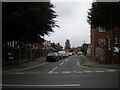
West end of James Street, Leabrooks
Seen from Greenhill Lane.
Image: © Richard Vince
Taken: 26 Sep 2020
0.09 miles
2
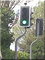
UK Puffin Crossing
UK Puffin Crossing on the Greenhill Lane, Leabrooks, Alfreton Derbyshire.
Image: © gary
Taken: 27 Jun 2015
0.10 miles
3
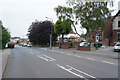
Greenhill Lane
These houses are rather more spacious than many in the area.
Image: © Malcolm Neal
Taken: 3 Jun 2021
0.12 miles
4
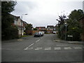
Emmerson Road, Riddings
Off Greenhill Lane.
Image: © Richard Vince
Taken: 26 Sep 2020
0.13 miles
5
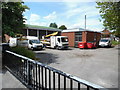
Leabrooks Telephone Exchange
Situated in Mill Lane off the B6016 Greenhill Lane, this TE would appear to date from the 1970s or thereabouts, and would have replaced a smaller building in the same locality. It has the code EMLEABR and provides telephone and broadband services to 8,935 residential 367 non-residential premises in Leabrooks, plus Ironville, Jacksdale, Riddings, Somercotes and Swanwick nearby. It is perhaps unfortunate that this building doesn't have a more prepossessing appearance, although as it is down a side road adjacent to other industrial premises, one could be forgiven for thinking that it is actually located in the area. Three red rubbish containers and four BT Openreach vehicles can be seen in this photo. Also, a black letterbox can just be seen to the left of the photo by the black gate although it probably wouldn't get much post apart from council tax and electricity bills to pay for the considerable cost of running this TE. The numbering range of this TE is (01773) 60xxxx, the (01773) referring to the Ripley group of nine TEs, and its postcode is DE55 4EX.
Image: © David Hillas
Taken: 5 Jul 2015
0.13 miles
6
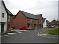
Hibbitt Close, Leabrooks
Providing access to some recently built housing off Greenhill Lane.
Image: © Richard Vince
Taken: 26 Sep 2020
0.14 miles
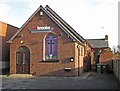
8
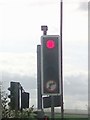
UK Red Traffic Light Signal
UK Red Traffic Light Signal on the Main Road, Leabrooks, Alfreton Derbyshire.
Image: © gary
Taken: 16 Jul 2015
0.16 miles
10

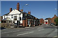
UK Green Traffic Light Signal
UK Green Traffic Light Signal at the busy crossroads junction outside the Three Horse Shoes,on the Main Road, Leabrooks Derbyshire.
Image: © gary
Taken: 24 Jan 2015
0.17 miles