IMAGES TAKEN NEAR TO
Stoneleigh Way, ALFRETON, DE55 1DL
Introduction
This page details the photographs taken nearby to Stoneleigh Way, DE55 1DL by members of the Geograph project.
The Geograph project started in 2005 with the aim of publishing, organising and preserving representative images for every square kilometre of Great Britain, Ireland and the Isle of Man.

There are currently over 7.5m images from over14,400 individuals and you can help contribute to the project by visiting https://www.geograph.org.uk
Image Map
Images are licensed for reuse under creativecommons.org/licenses/by-sa/2.0
Notes
- Clicking on the map will re-center to the selected point.
- The higher the marker number, the further away the image location is from the centre of the postcode.
Image Listing (14 Images Found)
Images are licensed for reuse under creativecommons.org/licenses/by-sa/2.0
Image
Details
Distance
1
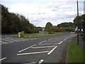
Derby Road, Swanwick
Looking towards Alfreton, near the northern edge of the village.
Image: © Richard Vince
Taken: 13 Oct 2018
0.08 miles
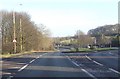
3

The Cross Keys, Swanwick
On Derby Road.
Image: © Richard Vince
Taken: 13 Oct 2018
0.10 miles


6

The Pantry & Bakery, Swanwick, Derbyshire
Image: © Martin Froggatt
Taken: 8 Dec 2019
0.15 miles
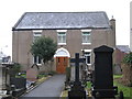
8

Floral display at Swanwick
Looking north at the junction of High Street, left, with the B6179 Alfreton Road.
Image: © Jonathan Billinger
Taken: 7 Sep 2009
0.17 miles
9

Swanwick Methodist Church, Derbyshire
Situated on the B6179 Derby Road, this church was originally built around 1845, whilst in 1875 a gallery was added. Subsequently, a further hall was built in 1928, and lastly in 1981 a modern foyer was added. This church is one of several such churches in the Borders Mission Methodist Circuit which covers East Derbyshire and West Nottinghamshire. Services takes place here every Sunday at 10.45am and 6.00pm, with activities being held during the week. For SatNav purposes, the postcode of this church is DE55 1AB.
Image: © David Hillas
Taken: 5 Jul 2015
0.18 miles