
IMAGES TAKEN NEAR TO
Corn Mill Close, MATLOCK, DE4 4BT
Introduction
This page details the photographs taken nearby to Corn Mill Close, DE4 4BT by members of the Geograph project.
The Geograph project started in 2005 with the aim of publishing, organising and preserving representative images for every square kilometre of Great Britain, Ireland and the Isle of Man.

There are currently over 7.5m images from over14,400 individuals and you can help contribute to the project by visiting https://www.geograph.org.uk
Image Map
Images are licensed for reuse under creativecommons.org/licenses/by-sa/2.0
Notes
- Clicking on the map will re-center to the selected point.
- The higher the marker number, the further away the image location is from the centre of the postcode.
Image Listing (25 Images Found)
Images are licensed for reuse under creativecommons.org/licenses/by-sa/2.0
Image
Details
Distance
1
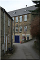
Speedwell Mill
Corn, later textile mill to the south of Wirksworth. Now a mixture of housing and small industrial premises. For more details see http://www.geograph.org.uk/photo/2327341
Image: © Alan Murray-Rust
Taken: 26 Mar 2011
0.02 miles
2
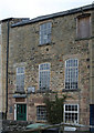
Speedwell Mill
Corn, later textile mill to the south of Wirksworth. Now a mixture of housing and small industrial premises.
Built in stages, this section probably dates from the early 19th century. See http://www.geograph.org.uk/photo/2327341
Image: © Alan Murray-Rust
Taken: 26 Mar 2011
0.03 miles
3
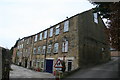
Speedwell Mill, Wirksworth
Three and four storey former mill building on the site of a former corn mill. The earliest section at the south end is around 1790 and there were two further stages of construction. It was a cotton mill and from 1844 it was a tape mill. There is a 'taking in door' and lifting beam in the near gable end.
Image: © Chris Allen
Taken: 26 Mar 2011
0.03 miles
4
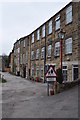
Ex Cotton Mill
An old mill has now been converted to several houses, one of a few mills in Wirksworth.
Image: © Ashley Dace
Taken: 26 Mar 2011
0.03 miles
5
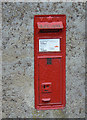
Millers Green postbox ref: DE4 337
VR wallbox with unmodified slot built into a house at Millers Green (see http://www.geograph.org.uk/photo/2329504 ).
Image: © Alan Murray-Rust
Taken: 26 Mar 2011
0.04 miles
6
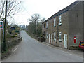
Millers Green, Wirksworth
This is the road to the neighbouring village of Kirk Ireton.
Image: © Alan Murray-Rust
Taken: 26 Mar 2011
0.06 miles
7
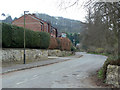
Cinder Lane, Wirksworth
Possibly descriptive of the surfacing at some time, but now fully metalled.
Image: © Alan Murray-Rust
Taken: 26 Mar 2011
0.09 miles
8
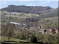
Houses and hillside south of Wirksworth
View across Millers Green to Round Meadow Farm on the hillside. View from the lane up to Hob Hall from Gorseybank.
Image: © Andrew Hill
Taken: 6 Apr 2013
0.09 miles
9
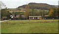
King's Field, Miller's Green, Wirksworth, Derbys
In the south-east corner of an extensive area of grassland shared by the local recreation ground and the Wirksworth and Middleton Cricket Club is this bowling green and clubhouse that belong to the Memorial Bowls Club. Miller's Green, a 'C' category road passes these premises runs on the left of this picture, albeit not visible here.
Image: © David Hallam-Jones
Taken: 18 Oct 2014
0.12 miles
10
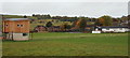
King's Field, Miller's Green, Wirksworth, Derbys
The cricket field used by the Wirksworth and Middleton Cricket Club. They were established in 1849 and 1880 respectively and finally merged in 2008. Wirksworth was once the centre of an important lead mining area - an expanse of 73,800 acres - known as the King's Field. In the C9th the area was owned by Repton Abbey and rent was paid to the Benedictine monks in the form of lead. When the Abbey was destroyed by the Danes in 875 AD, the area came under the control of the Danish King. In the Kings Field area, south of Wirksworth, individuals were allowed to search for lead, subject to the laws and customs of the appointed mining authority.
Image: © David Hallam-Jones
Taken: 18 Oct 2014
0.13 miles