IMAGES TAKEN NEAR TO
Crawley Road, DERBY, DE24 9GA
Introduction
This page details the photographs taken nearby to Crawley Road, DE24 9GA by members of the Geograph project.
The Geograph project started in 2005 with the aim of publishing, organising and preserving representative images for every square kilometre of Great Britain, Ireland and the Isle of Man.

There are currently over 7.5m images from over14,400 individuals and you can help contribute to the project by visiting https://www.geograph.org.uk
Image Map
Images are licensed for reuse under creativecommons.org/licenses/by-sa/2.0
Notes
- Clicking on the map will re-center to the selected point.
- The higher the marker number, the further away the image location is from the centre of the postcode.
Image Listing (5 Images Found)
Images are licensed for reuse under creativecommons.org/licenses/by-sa/2.0
Image
Details
Distance
1
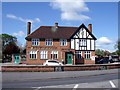
The Brackens
Also known as The Brackens Hotel, but just a pub, nowadays.
Image: © Ian Calderwood
Taken: 12 May 2012
0.13 miles
2
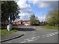
Bus stop, Boulton Lane, Alvaston
Situated on a cutoff between Boulton Lane proper and its service road (foreground), this bus stop was arranged so buses could turn round, using a very short length of Bracknell Drive (behind the photographer) to regain Boulton Lane. However, this has not been a terminus for many years, buses serving this area on a circular basis (anticlockwise buses still use this stop).
Image: © Richard Vince
Taken: 4 May 2019
0.17 miles
3
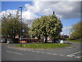
Former bus turning circle, Boulton Lane, Alvaston
Formed by cutting diagonally across the reservation between Boulton Lane and its service road immediately north east of the junction with Bracknell Drive (from which this shot was taken). The bus stop visible on the right is in the cutoff, but this has not been a terminus for many years, buses serving this area on a circular basis (anticlockwise buses still use the cutoff).
Image: © Richard Vince
Taken: 4 May 2019
0.18 miles
4
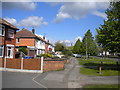
Pavement, Boulton Lane, Alvaston
Along the north side of the road west of the junction with Bracknell Drive.
Image: © Richard Vince
Taken: 4 May 2019
0.22 miles