
IMAGES TAKEN NEAR TO
Rykneld Way, DERBY, DE23 4AS
Introduction
This page details the photographs taken nearby to Rykneld Way, DE23 4AS by members of the Geograph project.
The Geograph project started in 2005 with the aim of publishing, organising and preserving representative images for every square kilometre of Great Britain, Ireland and the Isle of Man.

There are currently over 7.5m images from over14,400 individuals and you can help contribute to the project by visiting https://www.geograph.org.uk
Image Map
Images are licensed for reuse under creativecommons.org/licenses/by-sa/2.0
Notes
- Clicking on the map will re-center to the selected point.
- The higher the marker number, the further away the image location is from the centre of the postcode.
Image Listing (16 Images Found)
Images are licensed for reuse under creativecommons.org/licenses/by-sa/2.0
Image
Details
Distance
1
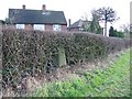
Glebe Lands
The edge of Derby. The field is sandwiched between the houses and the A38 and must be a target for housing development. Triangulation pillar hidden in the hedge.
Image: © Richard Webb
Taken: 22 Feb 2004
0.06 miles
2
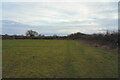
The corner of the field
Following the hedge that makes the field boundary we will soon be turning another corner.
Image: © Malcolm Neal
Taken: 24 Feb 2021
0.14 miles
3
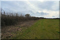
By the hedge
The field is empty of animals but there is some evidence that cattle do graze here from the cow pats scattered around the grass.
Image: © Malcolm Neal
Taken: 24 Feb 2021
0.16 miles
4

The track turns to the left
The path continues round the field edge alongside a hedge that was roughly trimmed down last year, looking at the new growth.
Image: © Malcolm Neal
Taken: 24 Feb 2021
0.18 miles
5

Field west of Heatherton (1)
Playing host to a public footpath, which turns right when it reaches the edge of the field visible ahead. The A38 is the other side of the hedgerow.
Image: © Richard Vince
Taken: 19 Apr 2019
0.19 miles
6

Burnaston : A38
Heading along the A38.
Image: © Lewis Clarke
Taken: 26 Sep 2020
0.19 miles
7

Field west of Heatherton (2)
Playing host to a public footpath, which is rather less visible now than it was in November: Image The A38 is the other side of the hedgerow on the left.
Image: © Richard Vince
Taken: 19 Apr 2019
0.20 miles


10

Slight evidence for ridge and furrow
The undulations are rather shallow but I think they are the remains of an ancient ridge and furrow way of farming.
Image: © Malcolm Neal
Taken: 24 Feb 2021
0.22 miles