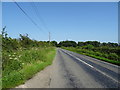
IMAGES TAKEN NEAR TO
Royal Grove, DERBY, DE21 2XY
Introduction
This page details the photographs taken nearby to Royal Grove, DE21 2XY by members of the Geograph project.
The Geograph project started in 2005 with the aim of publishing, organising and preserving representative images for every square kilometre of Great Britain, Ireland and the Isle of Man.

There are currently over 7.5m images from over14,400 individuals and you can help contribute to the project by visiting https://www.geograph.org.uk
Image Map
Images are licensed for reuse under creativecommons.org/licenses/by-sa/2.0
Notes
- Clicking on the map will re-center to the selected point.
- The higher the marker number, the further away the image location is from the centre of the postcode.
Image Listing (10 Images Found)
Images are licensed for reuse under creativecommons.org/licenses/by-sa/2.0
Image
Details
Distance
1
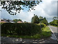
Footpath to Morley Road
Off Derby Road at Chaddesden Common.
Image: © Peter Barr
Taken: 9 Jul 2011
0.08 miles
2

The King's Corner, Chaddesley Common
A pub at the furthest point of housing development on the north-east edge of Derby.
Image: © Jonathan Billinger
Taken: 1 May 2008
0.09 miles
3

Welcome to Oakwood
A suburb of Derby, at the north east of the city, at the junction of Lime Lane and Derby Road, and a pub called King's Corner.
Image: © Peter Barr
Taken: 9 Jul 2011
0.11 miles
4

Cross Roads Farm
Cross Roads Farm, junction of Lime lane and Morley Road, the main farmhouse was built in 1972
https://web.archive.org/web/20060625154440/http://www.picturesofderby.co.uk/area_oakwood.htm
Image: © mike smith
Taken: Unknown
0.14 miles


7
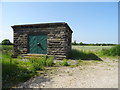
Small stone building, Kings Corner
Off Derby Road.
Image: © JThomas
Taken: 29 Jun 2019
0.22 miles
8
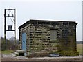
Kings Corner valve house
This little building houses control gear for the Derwent Valley aqueduct, which was built to convey water from the Howden and Derwent reservoirs in the Peak District to Derby and Leicester. It was built by the Derwent Valley Water Board in about 1915, in rather grim-looking gritstone quarried in the Peak District.
Image: © Richard Green
Taken: 31 Jan 2011
0.22 miles
9
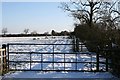
Gate and hedge off Lime Lane
In the distance, King's Corner.
Image: © David Lally
Taken: 3 Jan 2010
0.23 miles