
IMAGES TAKEN NEAR TO
Dahlia Drive, DERBY, DE21 2XJ
Introduction
This page details the photographs taken nearby to Dahlia Drive, DE21 2XJ by members of the Geograph project.
The Geograph project started in 2005 with the aim of publishing, organising and preserving representative images for every square kilometre of Great Britain, Ireland and the Isle of Man.

There are currently over 7.5m images from over14,400 individuals and you can help contribute to the project by visiting https://www.geograph.org.uk
Image Map
Images are licensed for reuse under creativecommons.org/licenses/by-sa/2.0
Notes
- Clicking on the map will re-center to the selected point.
- The higher the marker number, the further away the image location is from the centre of the postcode.
Image Listing (12 Images Found)
Images are licensed for reuse under creativecommons.org/licenses/by-sa/2.0
Image
Details
Distance
1
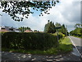
Footpath to Morley Road
Off Derby Road at Chaddesden Common.
Image: © Peter Barr
Taken: 9 Jul 2011
0.12 miles
2
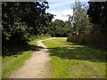
Path off Smalley Drive, Oakwood
Leading to Harvest Way.
Image: © Richard Vince
Taken: 3 Aug 2019
0.17 miles
3
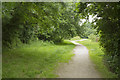
A green oasis
This small patch of wood and grass is just off Smalley Drive on the very edge of Oakwood and hence Derby.
Image: © Malcolm Neal
Taken: 20 Jun 2017
0.18 miles
4
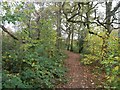
Lime Lane Wood in Chaddesden
Small area of woodland which is also a designated Nature Reserve.
Image: © Jonathan Clitheroe
Taken: 2 Nov 2014
0.18 miles
5

The King's Corner, Chaddesley Common
A pub at the furthest point of housing development on the north-east edge of Derby.
Image: © Jonathan Billinger
Taken: 1 May 2008
0.19 miles
6
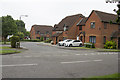
Goodrington Road
A road in name only. This leads to another even shorter piece of road which is essentially a cul de sac. It is opposite the small rectangular wood off Smalley Drive.
Image: © Malcolm Neal
Taken: 20 Jun 2017
0.20 miles
7
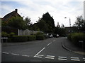
Tenby Drive, Oakwood
Off Saundersfoot Way.
Image: © Richard Vince
Taken: 3 Aug 2019
0.21 miles
8

Welcome to Oakwood
A suburb of Derby, at the north east of the city, at the junction of Lime Lane and Derby Road, and a pub called King's Corner.
Image: © Peter Barr
Taken: 9 Jul 2011
0.21 miles
9
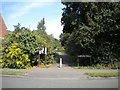
Path into Lime Lane Wood Local Nature Reserve, Oakwood
Off Smalley Drive.
Image: © Richard Vince
Taken: 3 Aug 2019
0.22 miles
10

Cross Roads Farm
Cross Roads Farm, junction of Lime lane and Morley Road, the main farmhouse was built in 1972
https://web.archive.org/web/20060625154440/http://www.picturesofderby.co.uk/area_oakwood.htm
Image: © mike smith
Taken: Unknown
0.22 miles