IMAGES TAKEN NEAR TO
Carpenter Close, BURTON-ON-TRENT, DE15 9AL
Introduction
This page details the photographs taken nearby to Carpenter Close, DE15 9AL by members of the Geograph project.
The Geograph project started in 2005 with the aim of publishing, organising and preserving representative images for every square kilometre of Great Britain, Ireland and the Isle of Man.

There are currently over 7.5m images from over14,400 individuals and you can help contribute to the project by visiting https://www.geograph.org.uk
Image Map
Images are licensed for reuse under creativecommons.org/licenses/by-sa/2.0
Notes
- Clicking on the map will re-center to the selected point.
- The higher the marker number, the further away the image location is from the centre of the postcode.
Image Listing (14 Images Found)
Images are licensed for reuse under creativecommons.org/licenses/by-sa/2.0
Image
Details
Distance
1
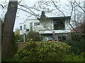
The White House
Although all the houses in this lane are large detached property this one stood out a different. It clearly is a mid 20th century design with flat roof and curved walls.
Image: © Mark Walton
Taken: 10 Apr 2007
0.11 miles
2
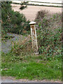
Old Boundary Marker on Brizlincote Lane
Municipal Boundary Marker on the east side of Brizlincote Lane. Brizlincote parish. Erected 1878 to mark the boundary of Burton on Trent borough. At that time on the boundary of Winshill and Bretby parishes in Derbyshire, now Brizlincote, Staffordshire and Bretby, Derbyshire. Removed in 2017 and re-erected at a nearby private location.
Milestone Society National ID: ST_BURT22pb
Image: © L Watson
Taken: 19 Feb 2015
0.13 miles
3
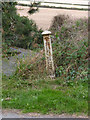
Boundary post on Brizlincote Lane
Standard Burton upon Trent cast iron post of mid 19th century origin.
Image: © Alan Murray-Rust
Taken: 24 Aug 2014
0.13 miles
4
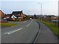
Beaufort Road into Brizlincote
Modern housing developments on the east side of Burton on Trent.
Image: © Richard Law
Taken: 13 Mar 2015
0.14 miles
5
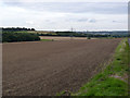
Derbyshire countryside
Open fields between Burton and Swadlincote.
Image: © Alan Murray-Rust
Taken: 24 Aug 2014
0.14 miles
6
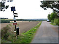
Brizlincote Lane
Note the old Burton boundary post http://www.geograph.org.uk/photo/4142113 on the left. Beyond this point the lane ceases to be a public road although it is still a public footpath.
Image: © Alan Murray-Rust
Taken: 24 Aug 2014
0.15 miles
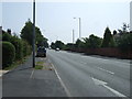
8
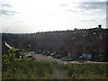
Brizlincote Valley
September 2009
Briz valley 22 years after it was started. Now finished.
The view is from the Stapenhill/Winshill border, to my back is the A511 & the Texaco garage.
Image: © Paul Wyss
Taken: 11 Sep 2009
0.17 miles
9
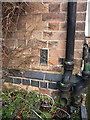
OS flush bracket - Winshill, Bleak House
OS flush bracket G3866 on the western gable end of the building known as Bleak House; originally levelled in 1956 at 121.875m above Ordnance Datum Newlyn.
Image: © Richard Law
Taken: 13 Mar 2015
0.17 miles