
IMAGES TAKEN NEAR TO
BURTON-ON-TRENT, DE14 9WB
Introduction
This page details the photographs taken nearby to DE14 9WB by members of the Geograph project.
The Geograph project started in 2005 with the aim of publishing, organising and preserving representative images for every square kilometre of Great Britain, Ireland and the Isle of Man.

There are currently over 7.5m images from over14,400 individuals and you can help contribute to the project by visiting https://www.geograph.org.uk
Image Map
Images are licensed for reuse under creativecommons.org/licenses/by-sa/2.0
Notes
- Clicking on the map will re-center to the selected point.
- The higher the marker number, the further away the image location is from the centre of the postcode.
Image Listing (118 Images Found)
Images are licensed for reuse under creativecommons.org/licenses/by-sa/2.0
Image
Details
Distance
1
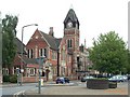
Town Hall
The Town Hall was built in 1894
Image: © Stanley Walker
Taken: 29 Jun 2006
0.00 miles
2
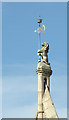
Town Hall (detail) at Burton-upon-Trent
This telephoto assisted image shows a highly decorative weather vane held by a very important-looking lion.
Image: © Roger D Kidd
Taken: 19 Oct 2011
0.00 miles
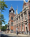
4
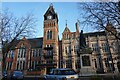
Burton Town Hall
On King Edward Place, Burton upon Trent.
Image: © Ian S
Taken: 9 Jan 2022
0.01 miles
5
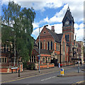
Burton Town Hall
The clock had stopped. The photograph was taken at twenty past two on a May afternoon.
Image: © John Sutton
Taken: 14 May 2016
0.01 miles
6
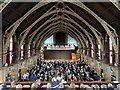
CAMRA GWBF 2023
CAMRA Great Winter Beer Festival 2023, Burton-on-Trent Town Hall.
Image: © Dave Pickersgill
Taken: 16 Feb 2023
0.01 miles
7
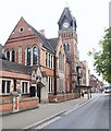
Town Hall, Burton upon Trent, Staffs.
The forerunner of the East Staffordshire District (later Borough) Council was created in 1878 and initially used a former Town Hall that stood in the Market Place. The building however, was unserviceable and was demolished in 1883, leaving Council meetings to be conducted in the back room of the nearby Angel public house. In 1891, Lord Burton offered these premises, the Saint Paul’s Institute and the Liberal Club buildings to the Borough as a Town Hall. The existing buildings, designed by the architect Reginald Churchill were added to by an 1894 extension of red brick with stone dressings. “Completion” occurred in 1892, and the Liberal Club element of the premises were converted into municipal offices. Its large hall and other rooms continuing to be used for public venue. In 1894 Lord Burton paid for an eastward extension over a bowling green, providing additional offices and on the first floor, a new council chamber. The front elevation looks out over St Paul's Place, whilst the western end of Borough Road can be glimpsed in the distance.
Image: © David Hallam-Jones
Taken: 12 Oct 2019
0.01 miles
8
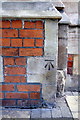
Benchmark on Burton Town Hall
Ordnance Survey cut mark benchmark described on the Bench Mark Database at http://www.bench-marks.org.uk/bm48593
Image: © Roger Templeman
Taken: 17 May 2013
0.02 miles
9
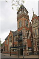
Burton Town Hall
There is an OS benchmark Image on a corner stone of the clock tower just right of the lamp post
Image: © Roger Templeman
Taken: 17 May 2013
0.02 miles
10
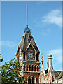
Town Hall clock tower in Burton-on-Trent, Staffordshire
Image: © Roger Kidd
Taken: 19 Oct 2011
0.02 miles