
IMAGES TAKEN NEAR TO
Octagon Centre, Orchard Street, BURTON-ON-TRENT, DE14 3QJ
Introduction
This page details the photographs taken nearby to Octagon Centre, Orchard Street, DE14 3QJ by members of the Geograph project.
The Geograph project started in 2005 with the aim of publishing, organising and preserving representative images for every square kilometre of Great Britain, Ireland and the Isle of Man.

There are currently over 7.5m images from over14,400 individuals and you can help contribute to the project by visiting https://www.geograph.org.uk
Image Map
Images are licensed for reuse under creativecommons.org/licenses/by-sa/2.0
Notes
- Clicking on the map will re-center to the selected point.
- The higher the marker number, the further away the image location is from the centre of the postcode.
Image Listing (118 Images Found)
Images are licensed for reuse under creativecommons.org/licenses/by-sa/2.0
Image
Details
Distance
1
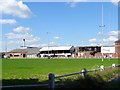
Peel Croft rugby ground
This has been the home of Burton Rugby Football Club for over 100 years but the club will soon be moving to new facilities at Tatenhill.
Image: © Ian Calderwood
Taken: 21 May 2019
0.06 miles
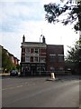
3
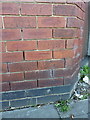
OS benchmark - Burton-on-Trent, 31 Lichfield Street
An OS cutmark on one of the few remaining original buildings in this part of the town centre; it was originally levelled at 46.037m above Ordnance Datum Newlyn.
Image: © Richard Law
Taken: 15 Jul 2015
0.07 miles

5
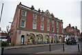
Former Corporation Fire Brigade Station
Dated 1903. On New Street, Burton upon Trent.
Image: © Ian S
Taken: 10 Jan 2022
0.11 miles
6

Shaftesbury House
Red brick Neo-Jacobean.
Image: © Jonathan Thacker
Taken: 21 Mar 2015
0.11 miles
7

Benchmark on #12 Ordish Street (Park Street face)
Ordnance Survey cut mark benchmark described on the Bench Mark Database at http://www.bench-marks.org.uk/bm48779
Image: © Roger Templeman
Taken: 25 May 2013
0.11 miles
8
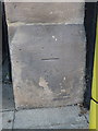
OS benchmark - Burton-on-Trent, 39 New Street
An OS cutmark on a pillar stone at 39 New Street, apparently once a fire station; it was originally levelled at 45.687m above Ordnance Datum Newlyn.
Image: © Richard Law
Taken: 15 Jul 2015
0.11 miles
9

Shaftesbury House
The red brick building with the Dutch style roof is Shaftesbury House. It stands at the junction of New, Orchard and Union Streets. Orchard and Union Streets are essentially the same street that just changes its name at the junction.
Image: © Malcolm Neal
Taken: 28 Feb 2018
0.11 miles
10

OS flush bracket G3867 - Burton-on-Trent, former Post Office
Flush Bracket G3867 on the front face of the former PO in New Street; installed as part of the 3rd Geodetic Levelling survey of England & Wales in 1956, and levelled at 45.778m above Ordnance Datum Newlyn.
Image: © Richard Law
Taken: 15 Jul 2015
0.11 miles