
IMAGES TAKEN NEAR TO
Horninglow Road, BURTON-ON-TRENT, DE14 2PZ
Introduction
This page details the photographs taken nearby to Horninglow Road, DE14 2PZ by members of the Geograph project.
The Geograph project started in 2005 with the aim of publishing, organising and preserving representative images for every square kilometre of Great Britain, Ireland and the Isle of Man.

There are currently over 7.5m images from over14,400 individuals and you can help contribute to the project by visiting https://www.geograph.org.uk
Image Map
Images are licensed for reuse under creativecommons.org/licenses/by-sa/2.0
Notes
- Clicking on the map will re-center to the selected point.
- The higher the marker number, the further away the image location is from the centre of the postcode.
Image Listing (37 Images Found)
Images are licensed for reuse under creativecommons.org/licenses/by-sa/2.0
Image
Details
Distance
1
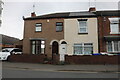
Grotty houses on Horninglow Road, Burton on Trent
Of course this is only my opinion, but what really upsets me is so many new houses are built looking like these, although they were built for Victorian industrial workers in much poorer times. There is no reason to imitate them now.
Image: © David Howard
Taken: 15 Aug 2021
0.03 miles
2
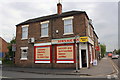
Pettitts Newsagents, #226 Horninglow Road
There is an OS benchmark Image on the Parker Street face of the building, left of the doorway
Image: © Roger Templeman
Taken: 17 May 2013
0.05 miles
3
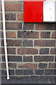
Benchmark on side of #226 Horninglow Road
Ordnance Survey cut mark benchmark described on the Bench Mark Database at http://www.bench-marks.org.uk/bm48646
Image: © Roger Templeman
Taken: 17 May 2013
0.05 miles
5
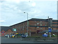
Midland Railway No. 4 Grain Warehouse and Bonded Store
Image: © Chris Gunns
Taken: 3 Jun 2017
0.10 miles
6
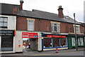
DGM (Burton) Ltd, #143 Derby Street
There is an OS benchmark Image on the white bricks below 'Slow 5' sign
Image: © Roger Templeman
Taken: 17 May 2013
0.11 miles
7
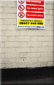
Benchmark on #143 Derby Street
Ordnance Survey cut mark benchmark described on the Bench Mark Database at http://www.bench-marks.org.uk/bm48651
Image: © Roger Templeman
Taken: 17 May 2013
0.11 miles
8
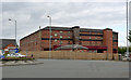
Former Midland Railway warehouse, Horninglow
Built in the late 19th century as a bonded stores and grain warehouse, thus neatly putting it at the beginning and end of the production chain of Burton's major industry, brewing. A feature of the building is the survival of the painted inscriptions on the outside.
Remarkably, since 2001 it has again been in use as a bonded store, although now belonging to a firm of private wine merchants providing the facility for merchants and private wine collectors to store their goods. Listed Grade II.
Image: © Alan Murray-Rust
Taken: 25 May 2014
0.11 miles
9

Pickford's Bonded Warehouse, Burton
This massive Victorian brick building bears the inscription, part of which is visible: "Midland Railway/Bonded Stores and Grain Warehouse No 4". "The grain warehouse is a significant relic of Burton's industrial history, illustrating the close connection between the brewing industry and the railway which served for transporting bulky raw materials" https://historicengland.org.uk/listing/the-list/list-entry/1038690 . Just off to the right is the power house which would have served it, shown in Image
In the background on the right is the Derby Turn Building, which faces the Derby Road on the other side.
Apologies for the reflections, betraying the fact that this was taken through a train window.
Image: © Derek Harper
Taken: 6 Apr 2012
0.12 miles
10
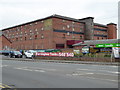
Midland Railway No. 4 Grain Warehouse
This is a massive warehouse and bonded store in Burton-on-Trent. There is a separate hydraulic power house nearby that powered the warehouse and associated sidings.
Image: © Chris Allen
Taken: 19 Mar 2016
0.12 miles