1
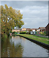
Grange Road off Shobnall Road, Burton upon Trent
Image: © Ian S
Taken: 10 Jan 2022
0.07 miles
2
Shobnall Road, Burton upon Trent
Image: © Ian S
Taken: 10 Jan 2022
0.09 miles
3
Fishing the Trent & Mersey Canal
This stretch of the canal is between bridges 32B and 33 in Shobnall.
Image: © Mat Fascione
Taken: 27 Jun 2015
0.10 miles
4
Trent and Mersey Canal, Shobnall, Staffordshire
The recently built housing in Jennings Way backs on to the canal here.
Image: © Roger D Kidd
Taken: 17 Oct 2009
0.10 miles
5
Trent and Mersey Canal, Shobnall, Staffordshire
The recently built housing in Jennings Way backs on to the canal here.
Image: © Roger D Kidd
Taken: 17 Oct 2009
0.10 miles
6
Trent and Mersey Canal at Burton-upon-Trent, Staffordshire
This shows the recent housing of Lyne Court, seen from Shobnall Road Bridge, No 33. The approaching narrowboat "Carey Ginger" is a hire craft from Stone.
Image: © Roger D Kidd
Taken: 18 Oct 2011
0.13 miles
7
The Trent & Mersey canal at Shobnall
Looking north, just north of Shobnall Marina.
Image: © Christine Johnstone
Taken: 3 May 2022
0.13 miles
8
Trent and Mersey Canal, Shobnall
Looking north.
Image: © JThomas
Taken: 19 Apr 2013
0.14 miles
9
Shobnall Marina in Burton-upon-Trent, Staffordshire
This marina is the headquarters of Jannel Cruisers who have been hiring boats out since 1973. The basin was originally the eastern end of the Bond End Canal to the Trent, much used by the breweries, which included one 3ft 9in drop lock. Connection with the Trent and Mersey (the Burton section was complete by 1770) was not allowed until 1794 - a long (and typical of the times) wrangle best read about on Jannel's own excellent and fascinating canal history webpage. http://www.jannel.co.uk/history.html
Image: © Roger Kidd
Taken: 18 Oct 2011
0.14 miles
10
Bridge No 33 at Shobnall, Staffordshire
On the Trent and Mersey Canal passing through Burton-upon-Trent, Shobnall Bridge carries the B5017 towards Newborough, but access to the A38(T) has to be to the right, then south-west to the Branston interchange, or way up north to Clay Mills.
Image: © Roger D Kidd
Taken: 17 Oct 2009
0.14 miles


