
IMAGES TAKEN NEAR TO
Dunstall Hill, BURTON-ON-TRENT, DE13 8BQ
Introduction
This page details the photographs taken nearby to Dunstall Hill, DE13 8BQ by members of the Geograph project.
The Geograph project started in 2005 with the aim of publishing, organising and preserving representative images for every square kilometre of Great Britain, Ireland and the Isle of Man.

There are currently over 7.5m images from over14,400 individuals and you can help contribute to the project by visiting https://www.geograph.org.uk
Image Map
Images are licensed for reuse under creativecommons.org/licenses/by-sa/2.0
Notes
- Clicking on the map will re-center to the selected point.
- The higher the marker number, the further away the image location is from the centre of the postcode.
Image Listing (14 Images Found)
Images are licensed for reuse under creativecommons.org/licenses/by-sa/2.0
Image
Details
Distance


4
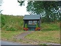
Bus stop, Dunstall
This very well-tended bus stop also serves as the village notice-board
Image: © Oliver Dixon
Taken: 5 Jul 2006
0.12 miles
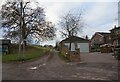
6

A corner of a grass field near Malthouse Row
A footpath enters/exits the field via the gap on the right.
Image: © Jonathan Thacker
Taken: 5 Aug 2025
0.12 miles

8

Grass field and woodland near Dunstall Cross
Image: © Jonathan Thacker
Taken: 5 Aug 2025
0.17 miles

10
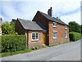
Dunstall Gate tollhouse
Surviving former road toll house (was Dunstall Gate) on the UC road, in parish of Dunstall (East Staffordshire District). Tollgate Cottage, Dunstall, DE13 8BE, on North side of road. A two-storey building of brick with a slate roof, in a design referred to as rectangular. Erected by an unknown Turnpike Trust in the 19th century.
Milestone Society National ID: ST.DUN
Image: © Alan Rosevear
Taken: 13 Jun 2014
0.19 miles