
IMAGES TAKEN NEAR TO
Church View, BURTON-ON-TRENT, DE13 0QR
Introduction
This page details the photographs taken nearby to Church View, DE13 0QR by members of the Geograph project.
The Geograph project started in 2005 with the aim of publishing, organising and preserving representative images for every square kilometre of Great Britain, Ireland and the Isle of Man.

There are currently over 7.5m images from over14,400 individuals and you can help contribute to the project by visiting https://www.geograph.org.uk
Image Map
Images are licensed for reuse under creativecommons.org/licenses/by-sa/2.0
Notes
- Clicking on the map will re-center to the selected point.
- The higher the marker number, the further away the image location is from the centre of the postcode.
Image Listing (27 Images Found)
Images are licensed for reuse under creativecommons.org/licenses/by-sa/2.0
Image
Details
Distance
1

Rolleston Road in Horninglow
Looking southward.
Image: © Peter Wood
Taken: 19 Jul 2016
0.04 miles
2
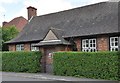
Former Parish Room - Horninglow
The building is situated on the Rolleston Road. The Parish Room of St John the Divine Horninglow is situated in the grounds of the vicarage for St. John's Church.It is a single room with toilet facililties. In the 1940's the room housed the Reception Class for the then Horninglow Junior Mixed and Infants' School whose main building was on Horninglow Road.
Image: © Brian Chadwick
Taken: 26 May 2009
0.05 miles
3
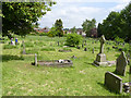
St John's Churchyard, Horninglow
Being given a springtime haircut.
Image: © Alan Murray-Rust
Taken: 15 May 2014
0.07 miles
4

Footpath to Farm Road
Farm Road was previously called Dog Lane.
Image: © Ian Calderwood
Taken: 23 Aug 2019
0.08 miles
5
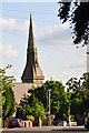
St. John's Church, Horninglow, from the Rolleston Road
The spire on this Church was badly damaged as a result of the Fauld ( Hanbury ) explosion in November 1944. The evidence of the rebuilding of the top of the spire is still apparent.
Image: © Brian Chadwick
Taken: 28 May 2009
0.10 miles

7
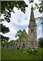
Church of St John the Divine, Horninglow
A typical church of the period of Victorian urban expansion. Built in 1866 to the design of Edward Holmes of Birmingham, it was originally dedicated to St John the Evangelist, but this had changed by 1911, probably by the then incumbent who was of the Anglo-Catholic persuasion.
Image: © Alan Murray-Rust
Taken: 15 May 2014
0.11 miles
8

Ordnance Survey Cut Mark
This can be found on a roadside wall in Horninglow Road.
For more detail see : http://www.bench-marks.org.uk/bm57523
Image: © Peter Wood
Taken: 19 Jul 2016
0.12 miles
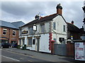
10

The Red Lion Inn, Horninglow
The Red Lion Inn stands on the junction of Rolleston Road, Horninglow Road North and Dover Road. The building on the left of the picture was once part of the 'maltings' complex on the Dover Road corner opposite.
Image: © Brian Chadwick
Taken: 29 May 2009
0.12 miles