
IMAGES TAKEN NEAR TO
Almond Court, BURTON-ON-TRENT, DE13 0HN
Introduction
This page details the photographs taken nearby to Almond Court, DE13 0HN by members of the Geograph project.
The Geograph project started in 2005 with the aim of publishing, organising and preserving representative images for every square kilometre of Great Britain, Ireland and the Isle of Man.

There are currently over 7.5m images from over14,400 individuals and you can help contribute to the project by visiting https://www.geograph.org.uk
Image Map
Images are licensed for reuse under creativecommons.org/licenses/by-sa/2.0
Notes
- Clicking on the map will re-center to the selected point.
- The higher the marker number, the further away the image location is from the centre of the postcode.
Image Listing (21 Images Found)
Images are licensed for reuse under creativecommons.org/licenses/by-sa/2.0
Image
Details
Distance
1

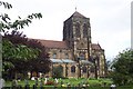
Church of St Mary, Stretton
An impressive late Victorian church, built 1895-97 to replace an earlier church of 1837 http://www.geograph.org.uk/photo/3863829. The church was commissioned by John Gretton of the famous brewing firm of Bass, Ratcliffe and Gretton, designed by the architectural firm of Micklethwaite & Somers Clarke. It forms a bold statement, with detailing largely in a derived Decorated style. Listed Grade II*.
Image: © Alan Murray-Rust
Taken: 21 Feb 2014
0.05 miles
2
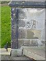
Bench mark, Stretton Church
See http://www.geograph.org.uk/photo/3863847 for location.
Image: © Alan Murray-Rust
Taken: 21 Feb 2014
0.06 miles
3
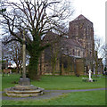
Church of St Mary, Stretton
An impressive late Victorian church, built 1895-97 to replace an earlier church (of 1838) the altar of which is marked by the tall cross http://www.geograph.org.uk/photo/3863829.
The church was commissioned by John Gretton of the famous brewing firm of Bass, Ratcliffe and Gretton, designed by the architectural firm of Micklethwaite & Somers Clarke. Listed Grade II*.
Image: © Alan Murray-Rust
Taken: 21 Feb 2014
0.06 miles
4
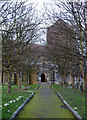
Church of St Mary, Stretton
The pathway from the lych gate to the main south porch.
There is a bench mark http://www.geograph.org.uk/photo/3863840 on the left hand buttress of the porch.
Image: © Alan Murray-Rust
Taken: 21 Feb 2014
0.07 miles
6
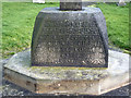
Churchyard cross base, Stretton
As the inscription indicates, this was the site of a precursor to the present church.
Image: © Alan Murray-Rust
Taken: 21 Feb 2014
0.08 miles
7

Old gravestones in the churchyard, Stretton
These have been tidied in a line near the churchyard wall, probably to make room for more recent burials.
Image: © Alan Murray-Rust
Taken: 2 May 2026
0.09 miles
8
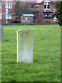
War Graves Commission gravestone in Stretton churchyard
Gravestones of this design are commonly associated with battlefields on the continent. In this instance the date of death, 19th November 1918, indicates that the soldier concerned (Pte R F Adkins) died of injuries subsequent to battle, either after being invalided home or because at that stage it was possible to have the body repatriated.
Image: © Alan Murray-Rust
Taken: 21 Feb 2014
0.09 miles

10
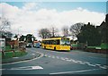
Bus on Church Road, Stretton
TrentBarton 941, a Dennis Dart SLF/Plaxton Pointer 2 recently repainted into Villager livery, pauses outside St Mary's Church while working a V2 from Derby to Burton via Mickleover, Etwall, Egginton, and Stretton. The V2 has since been withdrawn, having been replaced by an increased frequency (and some mild diversions) to the less direct V1 route.
Image: © Richard Vince
Taken: 2 Mar 2007
0.09 miles