
IMAGES TAKEN NEAR TO
Lancelot Drive, BURTON-ON-TRENT, DE13 0GJ
Introduction
This page details the photographs taken nearby to Lancelot Drive, DE13 0GJ by members of the Geograph project.
The Geograph project started in 2005 with the aim of publishing, organising and preserving representative images for every square kilometre of Great Britain, Ireland and the Isle of Man.

There are currently over 7.5m images from over14,400 individuals and you can help contribute to the project by visiting https://www.geograph.org.uk
Image Map
Images are licensed for reuse under creativecommons.org/licenses/by-sa/2.0
Notes
- Clicking on the map will re-center to the selected point.
- The higher the marker number, the further away the image location is from the centre of the postcode.
Image Listing (21 Images Found)
Images are licensed for reuse under creativecommons.org/licenses/by-sa/2.0
Image
Details
Distance
1
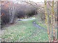
Jinny Nature Trail
The result of Rail closure.
Image: © Eric Harlow
Taken: 2 Dec 2007
0.05 miles
2
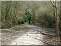
Nature trail heading north, Stretton
Former branch line of the North Staffordshire Railway.
Image: © JThomas
Taken: 19 Apr 2013
0.05 miles
3
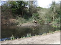
Pond on the nature trail
Former branch line of the North Staffordshire Railway.
Image: © JThomas
Taken: 19 Apr 2013
0.07 miles
4
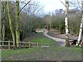
Jinny Nature Trail
Formed along the trackbed of the former Burton to Tutbury branch railway. Hard to believe that this was once the site of a station (Stretton and Claymills).
Image: © Alan Murray-Rust
Taken: 21 Feb 2014
0.08 miles
5
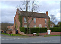
Bridge Farmhouse, Stretton
Early 19th century farmhouse, the asymmetric treatment of the frontage being relatively unusual. Listed Grade II.
Image: © Alan Murray-Rust
Taken: 21 Feb 2014
0.08 miles
7
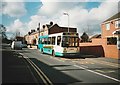
Bus on Bridge Street, Stretton
Arriva Midlands 2009, a Dennis Dart/East Lancs EL2000 that began life with Midland Red North, arrives at the terminus of route 14 from Winshill via Burton town centre. At this time, local services around Burton and Swadlincote were mainly operated with step entrance Darts, several of which were from this batch that had originally been based in Shrewsbury and Cannock.
Image: © Richard Vince
Taken: 2 Mar 2007
0.11 miles

9
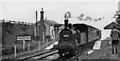
Stretton & Clay Mills station with local train, 1949
View south, towards Burton-on-Trent: ex-NSR Burton - Tutbury/Egginton Junction branches. The train for Tutbury is headed by ex-Midland Johnson class 1P 0-4-4T No. 58036 (LMS No. 1255) (built 11/1876, withdrawn 7/50). The station closed 1/9/49 (goods 7/6/65), passenger services to Egginton Junction having ceased 4/12/39, to Tutbury 1960 (goods 1968).
Image: © Walter Dendy, deceased
Taken: 26 Mar 1949
0.12 miles
10
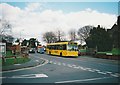
Bus on Church Road, Stretton
TrentBarton 941, a Dennis Dart SLF/Plaxton Pointer 2 recently repainted into Villager livery, pauses outside St Mary's Church while working a V2 from Derby to Burton via Mickleover, Etwall, Egginton, and Stretton. The V2 has since been withdrawn, having been replaced by an increased frequency (and some mild diversions) to the less direct V1 route.
Image: © Richard Vince
Taken: 2 Mar 2007
0.12 miles