
IMAGES TAKEN NEAR TO
London Road, DERBY, DE1 2QY
Introduction
This page details the photographs taken nearby to London Road, DE1 2QY by members of the Geograph project.
The Geograph project started in 2005 with the aim of publishing, organising and preserving representative images for every square kilometre of Great Britain, Ireland and the Isle of Man.

There are currently over 7.5m images from over14,400 individuals and you can help contribute to the project by visiting https://www.geograph.org.uk
Image Map
Images are licensed for reuse under creativecommons.org/licenses/by-sa/2.0
Notes
- Clicking on the map will re-center to the selected point.
- The higher the marker number, the further away the image location is from the centre of the postcode.
Image Listing (285 Images Found)
Images are licensed for reuse under creativecommons.org/licenses/by-sa/2.0
Image
Details
Distance
1
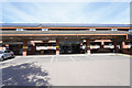
The main entrance to the Community Hospital
The community hospital has no A&E but is still a very busy hospital catering for a range of less serious problems and mainly for older people.
Image: © Malcolm Neal
Taken: 14 Sep 2019
0.03 miles
2
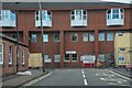
Derby : Litchurch Street
Derby Road Community Hospital in view.
Image: © Lewis Clarke
Taken: 25 Sep 2020
0.05 miles
3
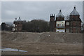
All that is left of the DRI
The two Victorian towers that used to front the Derby Royal Infirmary on London Road. As listed buildings they are the only parts that were not demolished. Eventually they will be encorporated into the new development.
Image: © Malcolm Neal
Taken: 9 Feb 2017
0.06 miles
4

Litchurch Street
A cul-de-sac street at the side of the community hospital on the edge of the former Derbyshire Royal Infirmary site.
Image: © Malcolm Neal
Taken: 14 Sep 2019
0.06 miles
5
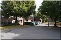
The end of Keble Close
This is the vehicle turning space at the end of Keble Close as it is blocked off from Oxford Street by a series of bollards.
Image: © Malcolm Neal
Taken: 25 Sep 2019
0.06 miles
6
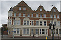
The Salvation Army Hostel
This building provides short term accommodation for the homeless. It is found on London Road Derby. As far as I can remember it has always been a hostel.
Image: © Malcolm Neal
Taken: 4 Jul 2017
0.06 miles
7
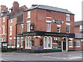
Derby - The Florence Nightingale
On London Road.
Image: © Dave Bevis
Taken: 10 Oct 2010
0.07 miles
8
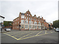
Box Junction, Midland Road/London Road, Derby
Image: © Stephen Craven
Taken: 18 May 2019
0.07 miles

10

London Road at Midland Road ? 1967
A pair of trolleybuses make their way in and out of the City Centre on routes 11 and 41 respectively. To the right the wiring leads to Midland Station, used by services 33 and 55.
The large building on the left is the Salvation Army men's hostel, now converted to apartments as Magee Court https://www.geograph.org.uk/photo/2103044 .
This is one of a series of views featuring buses in the 60s, 70s, and 80s. http://www.geograph.org.uk/search.php?i=2114547&displayclass=slide
Image: © Alan Murray-Rust
Taken: 30 Jul 1967
0.07 miles