
IMAGES TAKEN NEAR TO
Navigation Street, SWADLINCOTE, DE12 7LW
Introduction
This page details the photographs taken nearby to Navigation Street, DE12 7LW by members of the Geograph project.
The Geograph project started in 2005 with the aim of publishing, organising and preserving representative images for every square kilometre of Great Britain, Ireland and the Isle of Man.

There are currently over 7.5m images from over14,400 individuals and you can help contribute to the project by visiting https://www.geograph.org.uk
Image Map
Images are licensed for reuse under creativecommons.org/licenses/by-sa/2.0
Notes
- Clicking on the map will re-center to the selected point.
- The higher the marker number, the further away the image location is from the centre of the postcode.
Image Listing (61 Images Found)
Images are licensed for reuse under creativecommons.org/licenses/by-sa/2.0
Image
Details
Distance
3
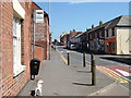
Up on high
Looking up High Street, Measham.
Image: © cris sloan
Taken: 2 May 2007
0.05 miles
4
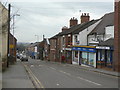
High Street, Measham
This is the old centre of the village which expanded enormously with the coming of the coal industry.
Image: © Alan Murray-Rust
Taken: 13 Mar 2010
0.05 miles
5

Measham High Street
This is where the High Street crossed the Ashby Canal.
The ends of the buildings facing https://historicengland.org.uk/listing/the-list/list-entry/1177912 are in a style typical of Joseph Wilkes https://en.wikipedia.org/wiki/Joseph_Wilkes Both buildings were constructed to serve the canal https://en.wikipedia.org/wiki/Ashby_Canal
https://meashammuseum.chessck.co.uk/Photographsofinterest has a photograph of the building on the left taken when the canal was in use.
Image: © Jonathan Thacker
Taken: 14 Jun 2021
0.05 miles
6
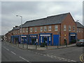
Supermarket on High Street
This part of High Street is in a Conservation Area which has clearly influenced the design of the shop fronts to look like more traditional ones. Compare this with http://www.geograph.org.uk/photo/1753845 .
Image: © Alan Murray-Rust
Taken: 13 Mar 2010
0.05 miles
7
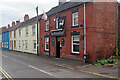
The White Hart, Measham
Measham, with a population of just over 5,000, is a former mining village (Measham Colliery closed in 1986) in the Leicestershire coalfield. Especially on a dull day it is, in all fairness, a rather drab looking place with no real centre that straggles along the former A453 road. Here on Bosworth Road, the White Hart is a traditional friendly back street local.
Image: © Stephen McKay
Taken: 27 Jul 2021
0.06 miles
8
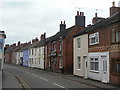
The White Hart
Because it looks so much like the neighbouring houses, I walked past this twice before noticing that it is in fact a public house.
Image: © Alan Murray-Rust
Taken: 13 Mar 2010
0.06 miles
9

Former canal building, Measham
The Ashby Canal https://en.wikipedia.org/wiki/Ashby_Canal crossed the picture from left to right.
The ends of the building facing https://historicengland.org.uk/listing/the-list/list-entry/1177912 is in a style typical of Joseph Wilkes https://en.wikipedia.org/wiki/Joseph_Wilkes
https://meashammuseum.chessck.co.uk/Photographsofinterest has a photograph of this building taken when the canal was in use.
Image: © Jonathan Thacker
Taken: 14 Jun 2021
0.06 miles
10

Gone but not forgotten
The Ashby Canal used to pass through the bridge built into this building on High Street but the restoration of the canal will see it cross the road via an aqueduct 50 or so metres down the road. The original line on the other side of High Street has been developed.
Image: © cris sloan
Taken: 2 May 2007
0.07 miles