
IMAGES TAKEN NEAR TO
Brick Kiln Croft, SWADLINCOTE, DE12 7JJ
Introduction
This page details the photographs taken nearby to Brick Kiln Croft, DE12 7JJ by members of the Geograph project.
The Geograph project started in 2005 with the aim of publishing, organising and preserving representative images for every square kilometre of Great Britain, Ireland and the Isle of Man.

There are currently over 7.5m images from over14,400 individuals and you can help contribute to the project by visiting https://www.geograph.org.uk
Image Map
Images are licensed for reuse under creativecommons.org/licenses/by-sa/2.0
Notes
- Clicking on the map will re-center to the selected point.
- The higher the marker number, the further away the image location is from the centre of the postcode.
Image Listing (49 Images Found)
Images are licensed for reuse under creativecommons.org/licenses/by-sa/2.0
Image
Details
Distance
1
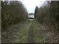
Footpath from Packington
The last stage follows a field access lane between the houses.
Image: © Alan Murray-Rust
Taken: 13 Mar 2010
0.04 miles
2
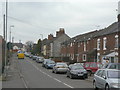
Leicester Road
Looking towards the centre of Measham. Earlier, this was known as Swepstone Lane.
Image: © Alan Murray-Rust
Taken: 13 Mar 2010
0.05 miles
3
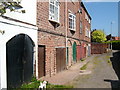
Underneath the arches
Curious garages built under Brickworks Cottages, off Bosworth Road.
Image: © cris sloan
Taken: 2 May 2007
0.07 miles
4
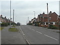
Leicester Road
The nearest houses to the right date from around 1920 with subsequent development coming after the Second World War.
Image: © Alan Murray-Rust
Taken: 13 Mar 2010
0.09 miles
5

Houses on Leicester Road
Seen from the footpath which crosses the fields to Packington. There are traces of ridge and furrow in this field.
Image: © Alan Murray-Rust
Taken: 13 Mar 2010
0.10 miles
6
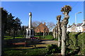
Measham Garden of Remembrance
The Garden is linked to a Centenary Field commemorating World War I
Image: © Tim Heaton
Taken: 25 Feb 2019
0.11 miles
7
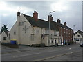
The White Swan and Nos.101-105 High Street
A traditional public house and a set of interesting cottages.
The latter are Listed Grade II, specifically because they are built using bricks called Measham 'gobs'. These were double-sized bricks designed to reduce the amount of Brick Tax payable. Unsurprisingly, legislation was amended to make double tax payable on double-sized bricks, so they were only produced for a relatively short period around the turn of the 19th century.
Image: © Alan Murray-Rust
Taken: 13 Mar 2010
0.13 miles
8
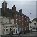
Nos.101-105 High Street
This is an enlarged version of part of Image to show the large Measham 'gobs' bricks.
These were double-sized bricks designed to reduce the amount of Brick Tax payable. Unsurprisingly, legislation was amended to make double tax payable on double-sized bricks, so they were only produced for a relatively short period around the turn of the 19th century. Because of this, the houses are Listed Grade II.
Image: © Alan Murray-Rust
Taken: 13 Mar 2010
0.13 miles
9

St Lawrence Church, Measham
View of the side entrance, St Lawrence
Image: © David Towle
Taken: 9 Aug 2011
0.14 miles
10

St Laurence's Church, Measham
The tower was built, according to the English Heritage listing 'shortly after 1733', this being the date when the medieval tower and spire collapsed.
Image: © Alan Murray-Rust
Taken: 13 Mar 2010
0.14 miles