
IMAGES TAKEN NEAR TO
Holly Close, SWADLINCOTE, DE12 6HZ
Introduction
This page details the photographs taken nearby to Holly Close, DE12 6HZ by members of the Geograph project.
The Geograph project started in 2005 with the aim of publishing, organising and preserving representative images for every square kilometre of Great Britain, Ireland and the Isle of Man.

There are currently over 7.5m images from over14,400 individuals and you can help contribute to the project by visiting https://www.geograph.org.uk
Image Map
Images are licensed for reuse under creativecommons.org/licenses/by-sa/2.0
Notes
- Clicking on the map will re-center to the selected point.
- The higher the marker number, the further away the image location is from the centre of the postcode.
Image Listing (4 Images Found)
Images are licensed for reuse under creativecommons.org/licenses/by-sa/2.0
Image
Details
Distance
2
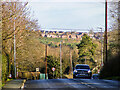
Ashby-de-la-Zouch, viewed from Norris Hill
The view of Ashby-de-la-Zouch from Moira/Norris Hill does not include any of the expected landmarks (Castle, St. Helen's, Loundoun Monument, Market Hall, etc.), but residential developments constructed in the last five years. Most distant prospects of the town are very much the same.
Image: © Oliver Mills
Taken: 31 Dec 2021
0.18 miles
3
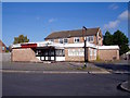
The Ashby Woulds
The Ashby Woulds opened in 1973 as an Everards house. By 2010, it was badly run-down and put up for sale as a "Public house/development land". Nothing much seems to have happened since.
Image: © Ian Calderwood
Taken: 20 Oct 2015
0.20 miles
4
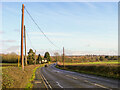
Moira Road, approaching Ashby-de-la-Zouch
A relatively featureless road, aside from a sparse distribution of farmhouses along its length. The surrounding countryside is very attractive, however, and there are multiple access points onto public rights of way and open-access woodland areas.
Image: © Oliver Mills
Taken: 31 Dec 2021
0.24 miles