
IMAGES TAKEN NEAR TO
Shortheath Road, SWADLINCOTE, DE12 6BW
Introduction
This page details the photographs taken nearby to Shortheath Road, DE12 6BW by members of the Geograph project.
The Geograph project started in 2005 with the aim of publishing, organising and preserving representative images for every square kilometre of Great Britain, Ireland and the Isle of Man.

There are currently over 7.5m images from over14,400 individuals and you can help contribute to the project by visiting https://www.geograph.org.uk
Image Map
Images are licensed for reuse under creativecommons.org/licenses/by-sa/2.0
Notes
- Clicking on the map will re-center to the selected point.
- The higher the marker number, the further away the image location is from the centre of the postcode.
Image Listing (23 Images Found)
Images are licensed for reuse under creativecommons.org/licenses/by-sa/2.0
Image
Details
Distance
1

All in the past
Lakeside Lodge fishing lake, who'd believe this used to be a scrapyard.
Image: © cris sloan
Taken: 19 May 2007
0.07 miles

3
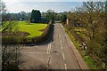
Shortheath Road from the Ashby Woulds Heritage Trail
Looking west from the bridge of the disused railway. The road to the left is Donisthorpe Lane.
Image: © Oliver Mills
Taken: 28 Feb 2021
0.09 miles
4
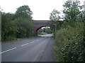
Up and over
Bridge over Shortheath Road, formerly for the railway.
Image: © cris sloan
Taken: 14 Sep 2007
0.10 miles
5
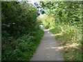
A dog's hind leg
The once straight lines of the Ashby/Nuneaton joint railway have been softenend by nature.
Image: © cris sloan
Taken: 14 Sep 2007
0.10 miles
6

Shortheath in south Derbyshire
Looking along Shortheath Road.
Image: © Mat Fascione
Taken: 26 Apr 2008
0.10 miles
7
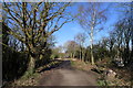
Bench on the line of the former Ashby and Nuneaton Joint Railway
The old track bed now shared by dog walkers and cyclists on Cycle Route 63
Image: © Tim Heaton
Taken: 25 Feb 2019
0.10 miles
8

Special
This unusual wildflower was identified by myself and a friend as Twiggy Mullein about four years ago and confirmed by an expert from Derby university. It is growing largely unnoticed by most on the disused railway line, its seeds blown along what is effectively a wind tunnel to germinate in the poor soil. There aren't many specimens of this lovely flower to be seen and this is made worse by the ignorance of the local 'rangers' who mow the verges bare without the slightest idea of the destruction they are causing.
Twiggy Mullein grows on only a handful of sites in Leicestershire and is a national rarity.
Image: © cris sloan
Taken: 14 Sep 2007
0.12 miles
9

Park Road, Moira
The lane becomes a footpath leading through to Moira Furnace.
Image: © Alan Murray-Rust
Taken: 5 Jun 2014
0.12 miles
10
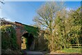
An old railway bridge on Park Road, Moira
The Ashby Woulds Heritage Trail runs along the disused railway, over the bridge.
Image: © Oliver Mills
Taken: 28 Feb 2021
0.14 miles