
IMAGES TAKEN NEAR TO
Barnes Lane, DE11 8GX
Introduction
This page details the photographs taken nearby to Barnes Lane, DE11 8GX by members of the Geograph project.
The Geograph project started in 2005 with the aim of publishing, organising and preserving representative images for every square kilometre of Great Britain, Ireland and the Isle of Man.

There are currently over 7.5m images from over14,400 individuals and you can help contribute to the project by visiting https://www.geograph.org.uk
Image Map
Images are licensed for reuse under creativecommons.org/licenses/by-sa/2.0
Notes
- Clicking on the map will re-center to the selected point.
- The higher the marker number, the further away the image location is from the centre of the postcode.
Image Listing (8 Images Found)
Images are licensed for reuse under creativecommons.org/licenses/by-sa/2.0
Image
Details
Distance
1
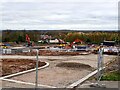
New building site
In 2021, Owl Homes began work on a new building site on the edge of Woodville.
Image: © Ian Calderwood
Taken: 19 Nov 2021
0.01 miles
2
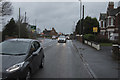
Looking back to the junction
Headlight full on even though it is around 10.30 in the morning, but the rain and heavy low clouds made for a very dull day.
Image: © Malcolm Neal
Taken: 29 Nov 2018
0.07 miles
3
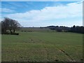
View Towards Blackfordby from Butt Lane
This area is currently subject to a housing development application.
Image: © Jonathan Clitheroe
Taken: 7 Mar 2015
0.08 miles
5
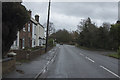
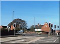
The A511
Just west of Woodville the road is very busy and I had to wait quite a while to get a photo in a gap in the traffic.
Image: © Malcolm Neal
Taken: 29 Nov 2018
0.12 miles

7
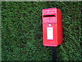
Red, Green, Black, White
Postbox by a hedge, Strawberry Lane, Blackfordby.
Image: © cris sloan
Taken: 4 Dec 2006
0.21 miles
8

A511 Woodville High Street
Joiners Arms public house
Image: © Chris Gunns
Taken: 10 Jun 2017
0.25 miles