
IMAGES TAKEN NEAR TO
Tannadice, FORFAR, DD8 3FA
Introduction
This page details the photographs taken nearby to DD8 3FA by members of the Geograph project.
The Geograph project started in 2005 with the aim of publishing, organising and preserving representative images for every square kilometre of Great Britain, Ireland and the Isle of Man.

There are currently over 7.5m images from over14,400 individuals and you can help contribute to the project by visiting https://www.geograph.org.uk
Image Map
Images are licensed for reuse under creativecommons.org/licenses/by-sa/2.0
Notes
- Clicking on the map will re-center to the selected point.
- The higher the marker number, the further away the image location is from the centre of the postcode.
Image Listing (10 Images Found)
Images are licensed for reuse under creativecommons.org/licenses/by-sa/2.0
Image
Details
Distance
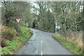
2
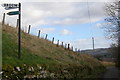
Signpost on the Glen Ogil / Tannadice Road depicting 'Broom Farm and Footpath to Wellford'
The footpath would lead through Broom Farm and onto the other access road to the farm on the Wellgate / Finavon Road.
Image: © Alan Morrison
Taken: 14 Mar 2009
0.18 miles
3

Entering Tannadice Village from Glen Ogil Road
The road that can be seen in the picture is Broomhill Road.
Image: © Alan Morrison
Taken: 14 Mar 2009
0.20 miles
4
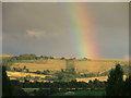
Unclassified road down to Tannadice
Evening rainbow over the Hill of Finavon in the distance.
Image: © Lloyd Housley
Taken: 2 Aug 2005
0.22 miles
5
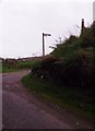
Road junction by Den of Baldoukie
Just north of Tannadice village - signposted to Broom farm.
Image: © Stanley Howe
Taken: 5 Oct 2015
0.22 miles
6
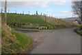
Glen Ogil / Tannadice Road at its junction with the road leading to Broom Farm
Photo taken looking south.
Image: © Alan Morrison
Taken: 14 Mar 2009
0.22 miles
7

Old Telephone Box at Tannadice
Telephone box in the village of Tannadice, now housing a defibrillator.
Image: © Scott Cormie
Taken: 26 May 2018
0.22 miles
8
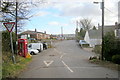
Broomhill Road, Tannadice at its junction with South Esk Road
The next road on the left leads to Tannadice School.
Image: © Alan Morrison
Taken: 14 Mar 2009
0.24 miles
9
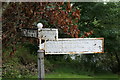
Old Road Sign
Old road sign on the banks of the South Esk as it runs past the Oathlaw and Tannadice Parish Church.
Image: © Mary Rodgers
Taken: 19 Aug 2020
0.24 miles
10
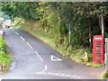
Telephone box, Tannadice
A K6 type telephone box beside the B957 in the centre of Tannadice.
Image: © Maigheach-gheal
Taken: 6 Oct 2009
0.25 miles