
IMAGES TAKEN NEAR TO
West High Street, FORFAR, DD8 1BG
Introduction
This page details the photographs taken nearby to West High Street, DD8 1BG by members of the Geograph project.
The Geograph project started in 2005 with the aim of publishing, organising and preserving representative images for every square kilometre of Great Britain, Ireland and the Isle of Man.

There are currently over 7.5m images from over14,400 individuals and you can help contribute to the project by visiting https://www.geograph.org.uk
Image Map
Images are licensed for reuse under creativecommons.org/licenses/by-sa/2.0
Notes
- Clicking on the map will re-center to the selected point.
- The higher the marker number, the further away the image location is from the centre of the postcode.
Image Listing (213 Images Found)
Images are licensed for reuse under creativecommons.org/licenses/by-sa/2.0
Image
Details
Distance
1
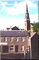
Forfar
Forfar is the county town of the ancient county of Angus, and it was a favourite residence of King Malcolm Canmore. Many of its buildings were built of the local sandstone in the 18th century
Image: © Anne Burgess
Taken: Unknown
0.02 miles
2
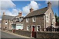
New Road
Some traditional houses at the foot of New Road.
Image: © Anne Burgess
Taken: 17 Apr 2007
0.02 miles
3
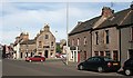
West High Street
The red car has just come down New Road and is about to turn into West High Street. Just behind it is Image There is a glimpse through the gap of the decorative trees in Little Causeway.
Image: © Anne Burgess
Taken: 13 Aug 2010
0.02 miles
4
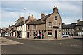
The Tolbooth
The Tolbooth is a public house which occupies the end house with the curved façade. I wish I could remember all the different names and styles of pub which have occupied these premises during my lifetime! West High Street descends to its left, and Little Causeway is behind it.
Image: © Anne Burgess
Taken: 13 Aug 2010
0.02 miles
5
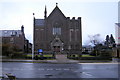
St. Margaret's Church, Forfar
Picture taken from New Road looking north.
Image: © Alan Morrison
Taken: 3 Mar 2009
0.02 miles
6
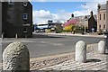
West High Street
This shows a long history of architecture. The gable on the left is probably 18th century, and the house behind the flowering trees a little later. The church, just seen on the right and in Image], is Victorian, and the blue-and-grey monstrosity is a 20th century bank. Note the old cobbles and granite setts side by side by the granite bollards in the foreground.
Image: © Anne Burgess
Taken: 17 Apr 2007
0.03 miles
7
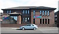
Ramsay Ladders Headquarters
Ramsay Ladders is a successful Forfar company, which has made its name and reputation manufacturing disappearing loft ladders. See http://www.ramsayladders.co.uk/
Image: © Anne Burgess
Taken: 13 Aug 2010
0.03 miles
8
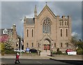
St Margaret's Kirk
Originally a Free Kirk, this is now one of the few churches still in active use in Forfar.
Image: © Anne Burgess
Taken: 17 Apr 2007
0.03 miles
9
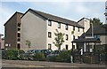
Springfield Sheltered Housing
Springfield is a block of modern council-run sheltered housing for elderly people.
Image: © Anne Burgess
Taken: 13 Aug 2010
0.03 miles
10
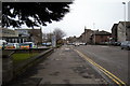
West High Street, Forfar
Photo taken looking east from Stark's Close.
Image: © Alan Morrison
Taken: 26 Feb 2010
0.04 miles