IMAGES TAKEN NEAR TO
Bruce Drive, CARNOUSTIE, DD7 7DF
Introduction
This page details the photographs taken nearby to Bruce Drive, DD7 7DF by members of the Geograph project.
The Geograph project started in 2005 with the aim of publishing, organising and preserving representative images for every square kilometre of Great Britain, Ireland and the Isle of Man.

There are currently over 7.5m images from over14,400 individuals and you can help contribute to the project by visiting https://www.geograph.org.uk
Image Map
Images are licensed for reuse under creativecommons.org/licenses/by-sa/2.0
Notes
- Clicking on the map will re-center to the selected point.
- The higher the marker number, the further away the image location is from the centre of the postcode.
Image Listing (10 Images Found)
Images are licensed for reuse under creativecommons.org/licenses/by-sa/2.0
Image
Details
Distance
1
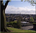
View across West Path
The two roads on either side of Carnoustie House Grounds are East Path and West Path. The East Path is now named Queen Street. Mackays Jam factory chimney can be seen in the centre of the picture. I believe production has now moved entirely to the Arbroath factory.
Image: © Gwen and James Anderson
Taken: 12 May 2009
0.21 miles
2
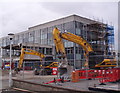
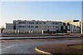
The Demolition of Carnoustie High School
The diggers are at rest for now, but with the new building completed it is only a matter of time before the rest of the building is demolished.
It is a very strange feeling to see the school go and I am sure many former pupils and teachers will feel a touch of sadness.
Image: © Gwen and James Anderson
Taken: 18 Apr 2009
0.21 miles
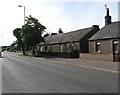
4
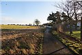
Path, Carnoustie
Path to Shanwell Cemetery passing Carnoustie High School.
Image: © Richard Webb
Taken: 24 Dec 2014
0.23 miles
6
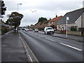
Barry Road (A930), Carnoustie
Heading east.
Image: © JThomas
Taken: 23 Oct 2013
0.24 miles
7
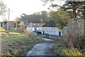
Shanwell Road
Beside Carnoustie High School.
Image: © Richard Webb
Taken: 24 Dec 2014
0.24 miles
8
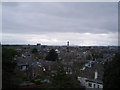
Carnoustie roof tops 2.
Looking south west. The chimney of Mackay's jam factory is prominent (soon to relocate to Arbroath) and the maltings to the left of the tower now being demolished.
Image: © Gwen and James Anderson
Taken: 12 May 2007
0.25 miles
9
Field behind Carnoustie
Stubble, very popular with jackdaws, beside Carnoustie High School.
Image: © Richard Webb
Taken: 24 Dec 2014
0.25 miles